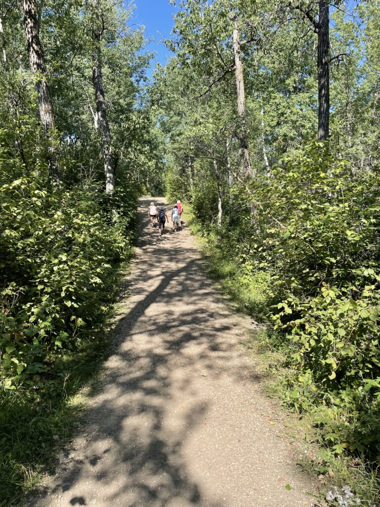
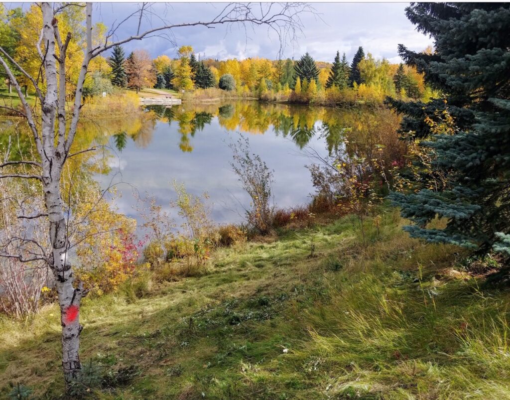
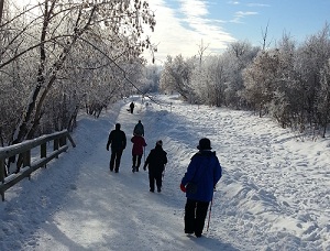
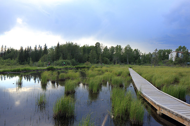
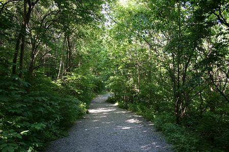
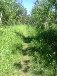
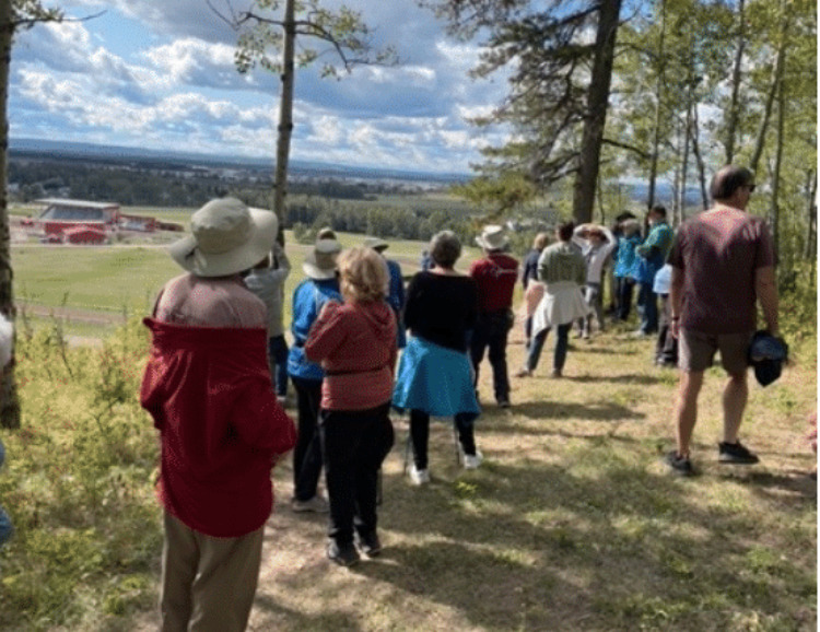
Permanent Trails – Routes that can be walked at your leisure.
The Volkssport clubs of Alberta have over 70 PTs across the province. That’s a compelling reason for out of town walkers to visit Alberta for a few weeks and experience some terrific walking.
The following are all found below: Start point link to Google maps, link to route directions, ratings (explanation of ratings available under FAQ tab), qualifying programs (see Special Program tab for abbreviations used ), contact person and link to page to find the Online Registration form. Many PTs have multiple routes so if printing them be careful to select the correct route if you are trying to complete a special program (Further details on these programs are also available at walks.ca )
Online Registration form means the instructions need to be downloaded/printed first, along with the Online registration form. “By downloading these instructions you and all members of your party are agreeing to our terms, which include signing our waiver before you start your walk.” Once the walk is completed the form along with payment is sent to the person designated on the form for credit. Check the form for full details.
A few walks still have an onsite walk box as well as an Online Registration option. If you are planning on using any of the limited local walk boxes pay careful attention to the opening times.
VAA is very proud of the walks in Alberta and would love to add more each year. If you have an idea for a new route contact us and hopefully we can make it happen.
Northern Lights and St Albert post all of their walks weekly to the Scheduled walk tab on this website. If you are in Barrhead or Medicine Hat please contact them for information on their weekly organized group walks.
ALBERTA WALK LOCATIONS
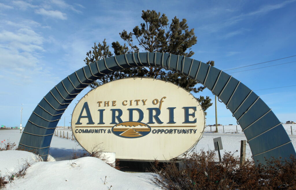
Airdrie 
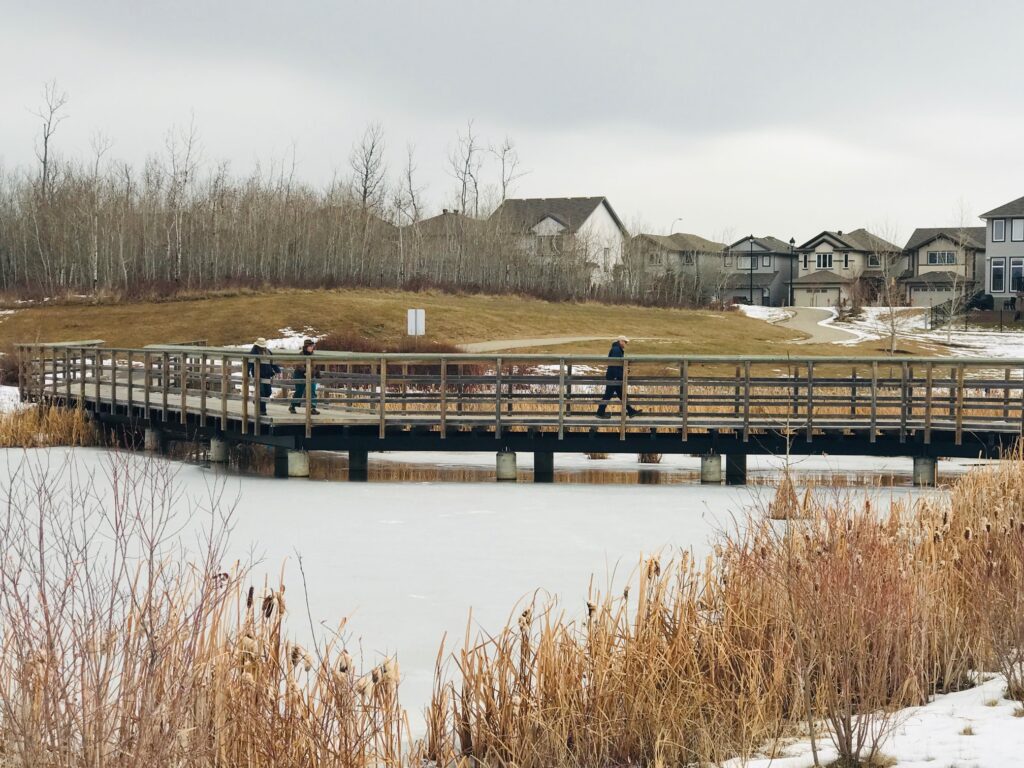
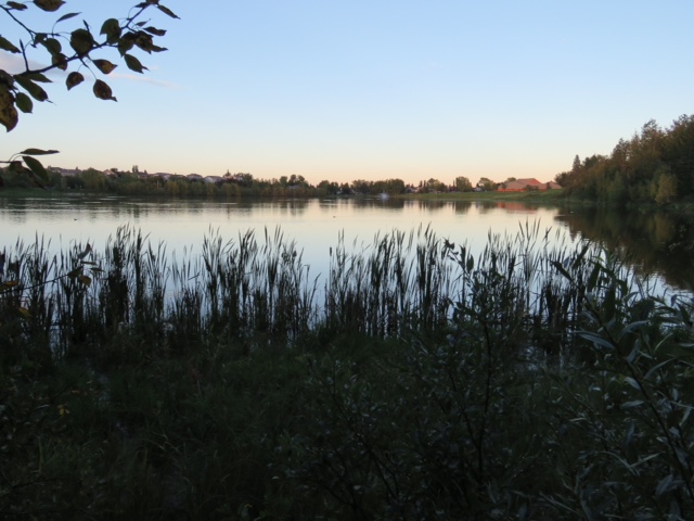
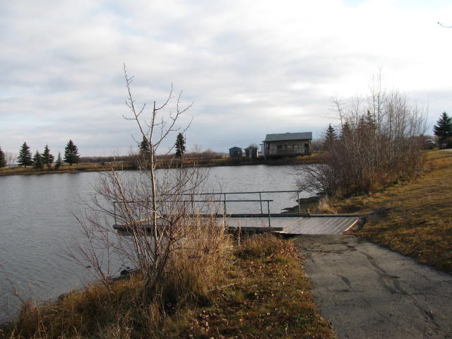
PT334 AIRDRIE With a population of over 77,000 just north of Calgary. This route follows the Airdrie trail system winding through parks and along creeks and streams.
JANUARY 1 – DECEMBER 31
SPONSOR CVF Alberta Director
CONTACT Denise
403-458-4316
REGISTRATION Online registration form
START POINT Genesis Place parking lot
800 East Lake Blvd. NE T4A 2K9
INSTRUCTIONS
Route A – 11 km
Route B – 5 km
RATING 1A
PROGRAMS TW
TRAIL Paved trails and sidewalks.
MISC Washrooms and ample parking at Genesis Place.
Banff
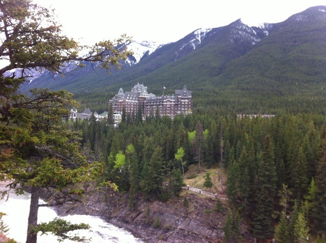
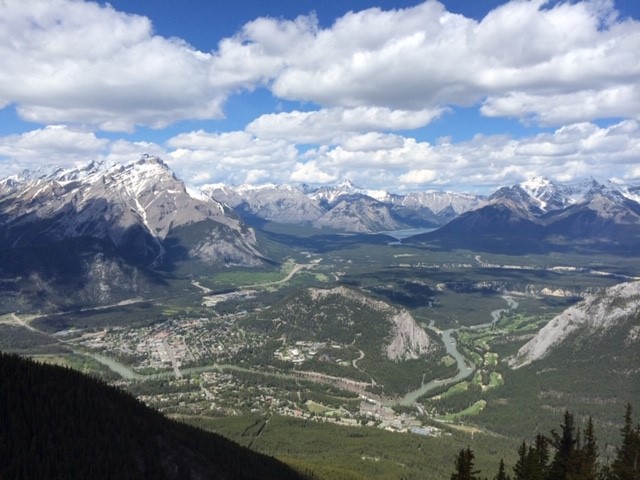
PT112 BANFF Is a resort town and one of Canada’s most popular tourist destinations. Known for its mountainous surroundings and hot springs with a resident population of over 8000. This PT features several routes in the town of Banff. See descriptions below.
JANUARY 1 – DECEMBER 31
SPONSOR CVF Alberta Director
CONTACT Denise
403-458-4316
(Trails) Mary
403-493-9810
REGISTRATIONOnline registration form
START POINT Canada Post
204 Buffalo St Banff T1L 1A0
DISTANCES 5, 6, 7, 10, 11, 12 & 13 km
INSTRUCTIONS See below
RATING See route instructions below
PROGRAMS APP BW FC M TW
TRAIL See descriptions below
MISC. National Park Pass required. Public washrooms available across street. Free parking available on upper floors of Bear Street Parkade.
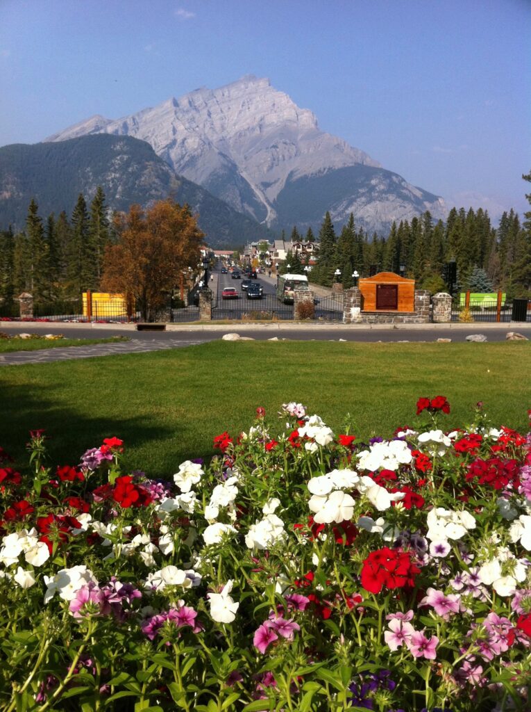
Banff PT112 ROUTE A is an easy walk through downtown Banff, up to the Banff Springs Hotel and Cascade Gardens. Rated 1B.
Banff PT112 ROUTES B & C explore a number of historic sites throughout the town. Rated 2B.
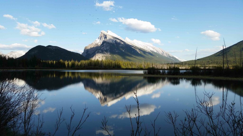
Banff PT112 ROUTE D VERMILION LAKES are a chain of lakes located immediately west of Banff town site. The route provides great views of Mount Rundle and Sulphur Mountain, among others. Rated 1B
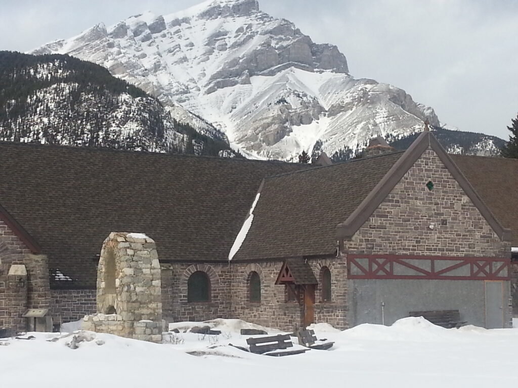
Banff PT112 ROUTE E CAVE AND BASIN Trek up to the Cave and Basin, birthplace of the Canadian National Park System. Natural warm mineral springs can be found inside and outside. There are steps and boardwalks. Rated 2B
Banff PT112 ROUTE F SUNDANCE CANYON This is a long walk and the 2 km at the end makes it worthwhile, assuming you are up for the tough 2 km hike through the narrow canyon. Rated 1B & 3C
Banff PT112 ROUTE G This additional in town route takes you to the Banff Springs Hotel and lovely Cascade Gardens and past the Indian Trading Post to the Warner Horse Stables. Rated 1B.
BANFF PT317 – SEASONAL SULPHUR MOUNTAIN named for the two sulphurous hot springs found on its lower slopes, will amaze you with awe-inspiring 360-degree views of six mountain ranges.
MAY 1 – OCTOBER 27
SPONSOR CVF Alberta Director
CONTACT Denise
403-458-4316
(Trails) Mary
403-493-9810
REGISTRATION Online registration form
START POINT Sulphur Mountain Gondola parking lot
INSTRUCTIONS 6 & 11 km
RATING 5D
PROGRAMS BW FC
TRAIL Trail switchbacks up to the peak of Sulphur Mountain, fantastic views from top. To complete the shorter distance a gondola ride is required
MISC. National Park Pass required. Washrooms available at Start Point.
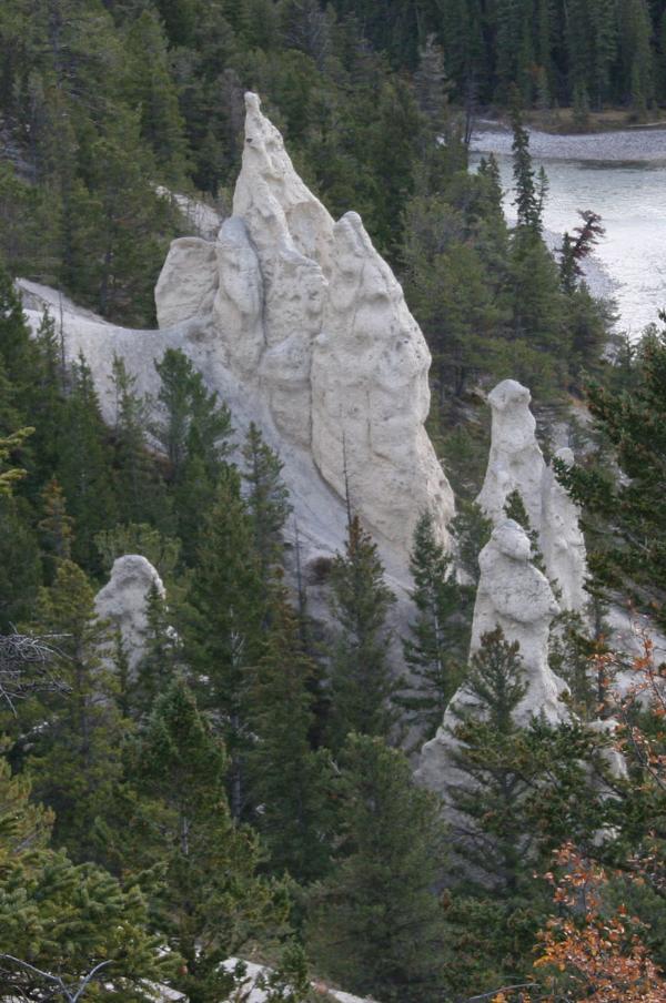
BANFF PT337 – SEASONAL The HOODOOS are rock formations that have been created through the natural process of erosion by water and wind. These are located in the Bow River Valley near The Banff town site.
MAY 1 – OCTOBER 27
SPONSOR CVF Alberta Director
CONTACT Denise
403-458-4316
(Trail) Mary
403-493-9810
REGISTRATION Online registration form
START POINT Canada Post
204 Buffalo St Banff T1L 1A0
INSTRUCTIONS 11 km Wear cleats until snow melts
RATING 3C
TRAIL The route goes through town to the beautiful trail beside the Bow River to the Hoodoos.
MISC. National Park Pass required. Public washrooms available across street. Free parking available on upper floors of Bear Street Parkade.
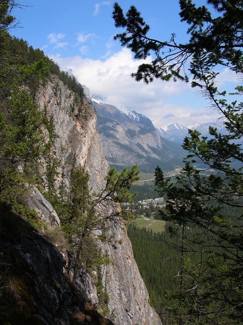
PT340 SEASONAL TUNNEL MOUNTAIN This walk takes you to the summit of Tunnel Mountain with breath taking views of the town of Banff. Although only 5500 feet in altitude above sea level, the summit is a magnificent viewpoint, revealing the Bow River Valley both east and west.
MAY 1 – OCTOBER 27
SPONSOR CVF Alberta Director
CONTACT Denise
403-458-4316
(Trails) Mary
403-493-9810
REGISTRATION Online registration form
START POINT Banff Train Station
327 Railway Ave. Banff T1L 1A9
INSTRUCTIONS 5 & 10 km
RATING 2B 4C
PROGRAMS APP M TW
TRAIL Five km around town, including Banff Centre. The 10 km route includes a 5 km return trip to the peak of Tunnel Mountain.
MISC National Park Pass required. Washrooms and free parking available at Start Point.
Barrhead
PT114 BARRHEAD is a vibrant town of just over 4500 people, about an hour north west of Edmonton, nestled beside the Paddle River.
JANUARY 1 – DECEMBER 31
SPONSOR Barrhead Walkie Talkie Volkssport Club
CONTACT Margaret or Tracey
Margaret: 780-674-4403 / Tracey: 780-674-1299
REGISTRATION Online registration form
START POINT A & W
4902-50 Ave T7N 1A6
INSTRUCTIONS 10 km and 5km
RATING 1A
PROGRAMS M
TRAIL Around the outskirts of the Town of Barrhead on paved & gravel trails, ravine and along the river.
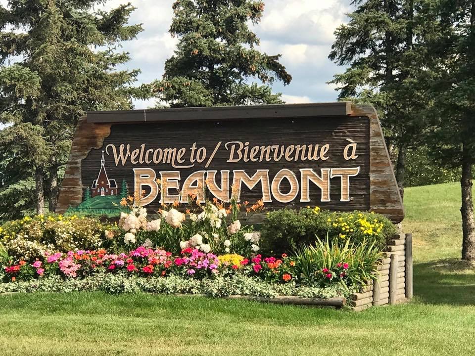
Beaumont
PT316 BEAUMONT originally a French farming community, it’s now a city with over 19,000 people. It is named for the “beautiful hill” on which St. Vital Church, built in 1919, is located within the centre of the city.
JANUARY 1 – DECEMBER 31
SPONSOR Northern Lights Walking Club
CONTACT Mary 780 920-5144
REGISTRATION Online registration form
START POINT Dairy Queen West route 6010-50 St. T4X 1T8
Ken Nichol Regional Rec Centre East route 5303 50 St T4X 1E5
Rising Star Daycare Southwest Route #101, 6102 29 Ave T4X 0H5
INSTRUCTIONS
5 & 10 km West
5 km East
10 km East
5 & 10 Southwest
RATING 1A 2A
PROGRAMS FC M MW
TRAIL Walk on paved trails around town and Don Sparrow Lake. The East route weaves around man made lakes.
MISC. Washrooms available at start.
Calgary
PT060 CALGARY This PT follows the Elbow River and goes through some very upscale neighborhoods.
JANUARY 1 – DECEMBER 31
SPONSOR CVF Alberta Director
CONTACT Denise
403-458-4316
REGISTRATION Online registration form
START POINT MNP Community & Sport Centre,
2225 MacLeod Tr. S. T2G 5B6
INSTRUCTIONS
Route A – 11 km
Route B – 5 km
RATING 1A
PROGRAMS APP
MISC. Plenty of free parking. Washrooms available at start
PT061 CALGARY Route A & B start from the Sports Centre. Routes C & D starts downtown
JANUARY 1 – DECEMBER 31
SPONSOR CVF Alberta Director
CONTACT Denise
403-458-4316
REGISTRATION Online registration form
START POINT Route A & B: MNP Community & Sport Centre, 2225 MacLeod Tr. S. T2G 5B6
Route C & D Sheraton Suites Eau Claire
255 Barclay Parade SW, Calgary T2P 5C2
INSTRUCTIONS
Route A & B – 6 & 11 km
Route C – 11 km
Route D – 5 km
RATING 1A 2A 3B
PROGRAMS APP M MW TW
MISC. Plenty of free parking at Centre. Washrooms available at start
Camrose
PT033 CAMROSE is a scenic community of over 19,000 people with many parks, leading to its moniker “The Rose City”.
JANUARY 1 – DECEMBER 31
SPONSOR Northern Lights Walking Club
CONTACT Mary 780 920-5144
REGISTRATION Online registration form
START POINT Camrose Recreation Center,
5600-44 Ave T4V 4J7
INSTRUCTIONS
Augustana Campus – 5 & 10 km
Mirror Lake – 10 km
Mirror Lake – 6 km
RATING 2A 2B
PROGRAMS APP M MW
TRAIL Explore the trails along the creek and lakes within the city. One route is through the Augusta University Campus
MISC Washrooms available at start
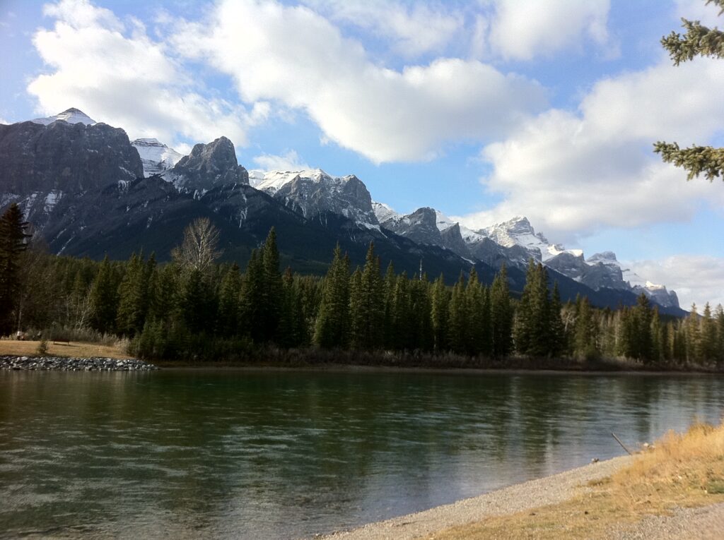
Canmore
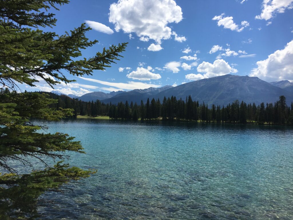
PT075 CANMORE The town of Canmore borders Banff National Park. It is surrounded by mountains making it one of the most impressive mountain towns in the world. Most routes provide excellent views of the Three Sisters Mountains and the Bow River.
Route A 11 km. Mountainside route on multiway trails, some stairs and wooded hiking trails. Poles may be useful.
Route B 10 km. In town route on multiway trails, sidewalks and gravel trails.
Route C 10 km. Scenic route goes partially in reverse of Route B, on trails surrounding the original townsite with a major portion of the walk along the Bow River.
Route D 5 km. On multiway trails and sidewalks around town.
Route E 6 & 7 km across the highway along Cougar Creek on gravel trails, multiway trails and sidewalks. The 7 km route should only be completed when there is no snow or ice. For the 7 km route, poles recommended for the portion on a wooded hiking trail.
Route F 5 km On trails along the Bow River and creeks surrounding the eastern portion of the original townsite.
JANUARY 1 – DECEMBER 31
SPONSOR CVF Alberta Director
CONTACT Denise 403-458-4316
Trails: Mary Wright 403-493-9810
REGISTRATION & START POINT Canmore Inn & Suites,
1402 Bow Valley Trail, T1W 1N5 403-609-4656
Optional Online registration form
INSTRUCTIONS
Route A – 11 km
Route B – 10 km
Route C – 10 km
Route D – 5 km
Route E – 6 & 7 km
Route F – 5 km
RATING 1B 2B
PROGRAMS APP BW M MW RT TW
REGISTRATION Dawn to dusk. Ask for Walk box at front desk.
MISC Washrooms available at start point.
TRAIL see descriptions above
Cardston
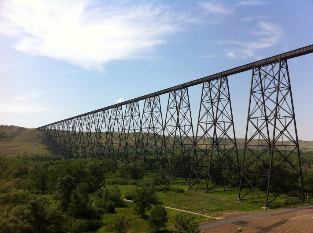
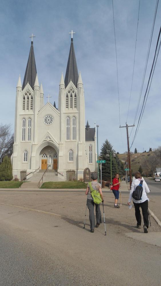
PT145 CARDSTON was founded in 1887 by members of The Church of Jesus Christ of Latter-day Saints. It has a population of over 3000. It is situated 77 Km southwest of Lethbridge and 25 km north of Montana.
JANUARY 2 – DECEMBER 31
SPONSOR CVF Alberta Director
CONTACT Denise
403-458-4316
REGISTRATION Online registration form
START POINTS Remington Carriage Museum
623 Main St., T0K 0K0 403-653-5139
Husky Station 60 1 Ave W T0K 0K0
INSTRUCTIONS
Remington 5 & 10 km
5 km Highlights
Husky 10 km
RATING 2B
PROGRAMS FC M MW TW
TRAIL Gravel and paved surfaces
MISC Parking and washrooms available at Start Points.
Chickakoo Lake
PT223 CHICKAKOO LAKE RECREATION AREA SEASONAL SNOWSHOE AND SKI Hike the remainder of the year.
JANUARY 1 – DECEMBER 31
SPONSOR CVF Alberta Director
CONTACT Denise
403-458-4316
REGISTRATION Online registration form
START POINT Chickakoo Lake Recreation Area
1128 Township Rd 534 T0E 1V0
INSTRUCTIONS 5 & 10 km
RATING 2B 3B
TRAIL Open 0800 – dusk. Grass and beautiful woodland trails
MISC Parking and toilets available at Start Point
Cochrane
PT364 COCHRANE The town of over 25,000 residents is located 18 km west of the Calgary city limits along Highway 1A. It is one of the fastest growing communities in Canada. The town is surrounded by Rocky View County.
JANUARY 1 – DECEMBER 31
SPONSOR CVF Alberta Director
CONTACT Denise
403-458-4316
REGISTRATION Online registration form
START POINTS Routes A, B, C & E at Mitford Park
201 Westrock Rd T4C 1M1
Route D at Glenbow Ranch Provincial Park
INSTRUCTIONS
Route A – 6 & 11 km
Route B – 11 km
Route C – 6 km
Route D – 6 & 12 km
Route E – 10 km
RATING 1A 1B 2B 3B
PROGRAMS APP M
TRAIL Dawn to Dusk. Choice of routes.
MISC. Washrooms available in area and along some routes.
Cold Lake
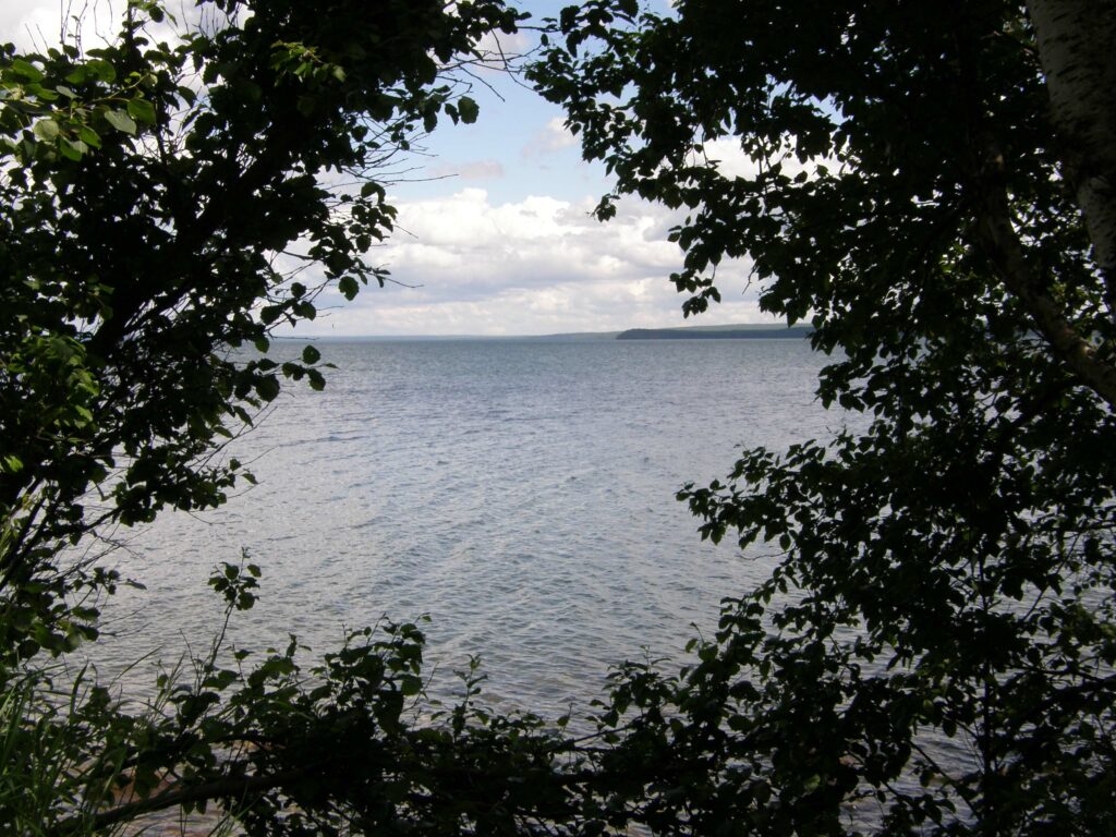
PT076 SEASONAL COLD LAKE has a population of over 15,000. The lake is one of Alberta’s largest and deepest lakes (the 7th largest in the province to be exact) and provides endless opportunities for fishing, boating and camping.
MAY 1 – OCTOBER 27
SPONSOR CVF Alberta Director
CONTACT Denise
403-458-4316
REGISTRATION Online registration form
START POINT Route A & B Cold Lake Provincial Park
Route C Cold Lake Marina parking lot, Lakeshore Dr & 8th Ave
INSTRUCTIONS
Route A – 6 & 10 km
Route B – 10 km
Route C – 6 & 10 km
RATING 1A 2B
PROGRAMS BW M
TRAIL Route A & B walks go through Cold Lake Provincial Park following trails through the park and campsite. Route C tours the marina and beach and some residential areas.
MISC No fee to enter park. Camping available.
Crowsnest Pass
PT224 SEASONAL CROWSNEST PASS an amalgamation of 5 communities in 1979 to form the municipality of Crowsnest Pass with a population of over 5500. Known for the tragedy that struck in 1903, when the tip of Turtle Mountain broke loose and decimated part of the Village of Frank. The Frank Slide Routes A & B tour the slide area.

MAY 1 – OBTOBER 27
SPONSOR CVF Alberta Director
CONTACT Denise
403-458-4316
REGISTRATION Online registration form
START POINT Route A & B Frank Slide Interpretive Centre
Route C Stone’s Throw Cafe, 13019 20 Ave, Blairmore
INSTRUCTIONS
Route A & B – 5 & 10 km not passable until snow melts
Route C – 6 km recommended in ice and snow
RATING 1A 2C
TRAIL Choice of in-town or wilderness trails.
MISC Washrooms available at start points.
Devon
PT047 DEVON is a town with a population of over 6500 which sits on the banks of the North Saskatchewan River, 26 km southwest of Edmonton.
JANUARY 1 – DECEMBER 31
SPONSOR Northern Lights Walking Club
CONTACT Mary
780 920-5144
REGISTRATION Online registration form
START POINTS IGA 51 Superior St T9G 1K8
Devon Golf and Convention Center
1130 River Valley T9G 1Z3
INSTRUCTIONS:
From IGA: 6 km and 11 km
From Golf Course: 5 km and 6 km and 10 km and 11 km
RATING 1A 1B 2A 3C
PROGRAMS APP BW FC M
TRAIL IGA routes tour around town through parks and green space. Golf course routes – through the river valley trails, ravines and the Lions campground.
MISC Parking and washrooms available at Start Points and an excellent menu at the Golf Course
Drumheller
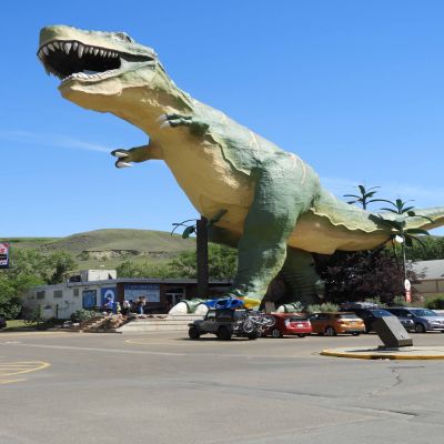
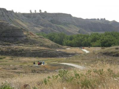
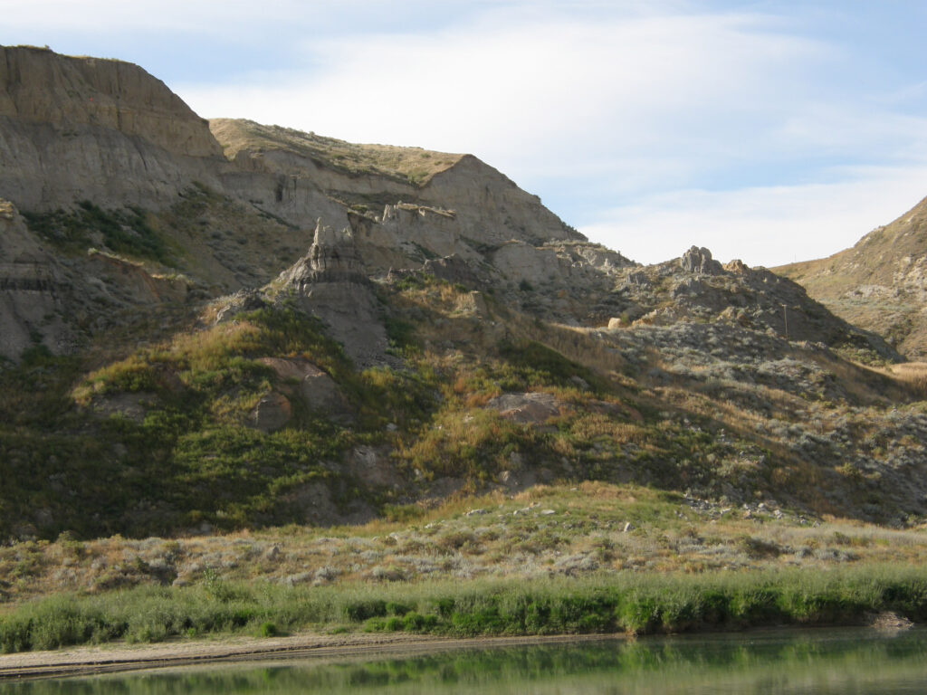
PT335 DRUMHELLER The town of Drumheller, within the Red Deer River Valley in the Badlands, is located 110 km northeast of Calgary. This portion of the Red Deer River Valley is often referred to as Dinosaur Valley, because of the many fossils found there.
JANUARY 1 – DECEMBER 31
SPONSOR CVF Alberta Director
CONTACT Denise
403-458-4316
REGISTRATION Online registration form
START POINT Drumheller Visitor Info Centre,
60 Riverside Dr W, T0J 0Y0
INSTRUCTIONS
Route A – 10 km
Route B – 6 km
RATING 1A 1B
PROGRAMS M MW TW
TRAIL Sidewalks and paved trails.
Dunvegan
PT367 SEASONAL DUNVEGAN is a historic site on the banks of the Peace River.
MAY 15 – SEPTEMBER 3
SPONSOR CVF Alberta Director
CONTACT Denise
403-458-4316
REGISTRATION Online registration form
START POINT Provincial Park Visitor Centre,
Hwy 2 & Township Rd 801A
INSTRUCTIONS 5 & 10 km
RATING 1B
PROGRAMS TW
TRAIL Paved & natural trails through historic site and market garden beside the Peace River.
MISC Parking and washrooms at Visitor Centre. Ice Cream in the garden gift shop..
Edmonton
PT012 EDMONTON East – The Jackson Heights walk goes through the Mill Creek Ravine and crosses a number of bridges
Jackie Parker goes through park and into walking trails in residential area. The Meadows uses great trails in the neighbourhoods of Tamarack and Maple
JANUARY 1 – DECEMBER 31
SPONSOR Northern Lights Walking Club
CONTACT Sylvie
780-668-9018
REGISTRATION Online registration form
START POINTS Jackson Heights Tim Hortons
4403 50 St. NW T6L 6X4
Jackie Parker Park 4540 50 St T8L 6B6
The Meadows Michaels 3741 17 St NW T6T 0C1
INSTRUCTIONS
6 & 11 km Jackson Heights/Mill Creek Ravine
6 & 10 km Jackie Parker
6 & 10 km The Meadows
RATING 1A 1B 3B
PROGRAMS FC MW
TRAIL Mostly gravel from Tims, hills can be slippery in the winter. Paved and gravel from the park.
MISC Washrooms available at start
PT013 EDMONTON North Saskatchewan River – The park walk crosses the river twice on two wonderful pedestrian bridges, providing some of the best views of the river.
JANUARY 1 – DECEMBER 31
SPONSOR Northern Lights Walking Club
CONTACT Margaret
780 996-1015 margaret@lyall.ca
REGISTRATION Online registration form
START POINTS Terwillegar Dog Park 16360 Rabbit Hill Rd NW (end of Road) T6R 0R7
Riverbend Safeway 576 Riverbend Square NW T6R 2E3
INSTRUCTIONS
Terwillegar 5, 7 &10 km
Riverbend 6 km and 10 km
RATING 1A 2B 3B
PROGRAMS APP
TRAIL Dawn to dusk
MISC Porta-potti available at start
PT014 EDMONTON West –
Grange Glastonbury Rated one of the best new walks of 2020.
– 10 km Through the Woods and Over the Boardwalk Route explores both the Grange and Glastonbury including the beautiful boardwalk and nature trail around numerous man made lakes.
– 6 km Through the Woods explores the Grange and nature trails around numerous man made lakes..
– 6 km Over the Boardwalk Route explores the trails around Guinevere Lake crossing the boardwalk with terrific views.
Wedgewood 6, 6 & 10 km enjoys the many multi use trails in the beautiful Wedgewood Heights neighborhood, a trail taking you into the Wedgewood Ravine and through the Cameron Heights neighborhood.
The Greens 6 & 10 km Many trails, some through the bush and ponds in Webber and Stewart Greens as well as Secord.
Edgemont 6 & 10 km Trails through the new Edgemont subdivision and along the Wedgewood Ravine.
JANUARY 1 – DECEMBER 31
SPONSOR Northern Lights Walking Club
CONTACT Laverne
780-288-6159
REGISTRATION Online registration form
START POINT (Grange Glastonbury) BMO
6220 199 St NW Edmonton T5T 2K4
(Wedgewood) Co-op Food Store
18370 Lessard Rd NW T6M 2X5
(The Greens) McDonalds
1296 Webber Greens Dr NW T5T 7C5
(Edgemont) Western Barcode parking lot
20130 Lessard Rd NW T6M 0T9
INSTRUCTIONS
Grange Glastonbury 10 km
Grange 6 km
Glastonbury 6 km
Wedgewood 6, 6 & 10 km
The Greens 6 km
The Greens 10 km
Edgemont 6 & 10 km
RATING 1A 1B 3B
PROGRAMS BW MW
TRAIL Mostly paved trails, see descriptions above.
MISC Washrooms available at starts in nearby businesses
PT034 EDMONTON Capital City This walk starts from the Kinsmen Sports Centre in the beautiful North Saskatchewan River Valley. It walks up the hill and around the Alberta Legislative buildings.
Route A takes you through the legislative grounds, downtown and across the High Level Bridge.
Route B takes you through the legislative grounds and park areas.
Route C crosses the new Walterdale Bridge, explores Rossdale, the legislature grounds & returns through parks.
Route D takes you through the legislature grounds & crosses the High Level Bridge.
Route E is a nice preview of the legislative grounds.
Route F crosses the Walterdale Bridge and visits the legislative grounds.
Route G takes you through the legislative grounds and park areas in Rossdale
JANUARY 1 – DECEMBER 31
SPONSOR St Albert Trekkers
CONTACT Joan 780-433-0282
REGISTRATION Online registration form
START POINT Kinsmen Sports Centre
9100 Walterdale Hill, T6E 2V3
INSTRUCTIONS
Route A – 10 km
Route B – 10 km
Route C – 10 km
Route D – 6 km
Route E – 6 km
Route F – 6 km
Route G – 11 km
RATING 2A 2B
PROGRAMS APP BW CC FC M MW
TRAIL See descriptions above.
MISC Ample parking. Washrooms available inside Sports Centre.
PT037 SEASONAL EDMONTON Capilano Highlands
This walk in the lovely North Saskatchewan River Valley starts from Capilano Park in the east of the city.
Route A 10 km passes beautiful historic houses on Ada Boulevard in the Highlands neighbourhood before entering the river valley trails in Dawson Park.
Route B 5 km also passes through historic Highlands before looping back along trails along the river
Route C 10 km goes through Gold Bar and Rundle Parks, crossing back and forth on different bridges as it follows the North Saskatchewan River.
Route D 6 km passes through Gold Bar Park before winding its way on mainly paved trails past a small lake in Rundle Park
Route E 10 km Stays on the south side of the river until crossing over on Dawson bridge coming back along north side of river. Due to slumping trail there is a revised route that stays away from the river.
Route F 6 km similar to Route A/B but avoids slumping trails by the river.
MAY 1 – OCTOBER 27
SPONSOR St Albert Trekkers
CONTACT Philippa
780-451-1956
REGISTRATION Online registration form
START POINT Capilano Park
North end of 50 St NW T6A 3R7
INSTRUCTIONS
Route A – 10 km Trail closed due to slumping
Route B – 5 km Trail closed due to slumping
Route C – 10 km
Route D – 6 km
Route E – 10 km Trail closed Revised Route E – 10 km
Route F – 6 km
RATING 1A 1B 2B
PROGRAMS FC
TRAIL see descriptions above
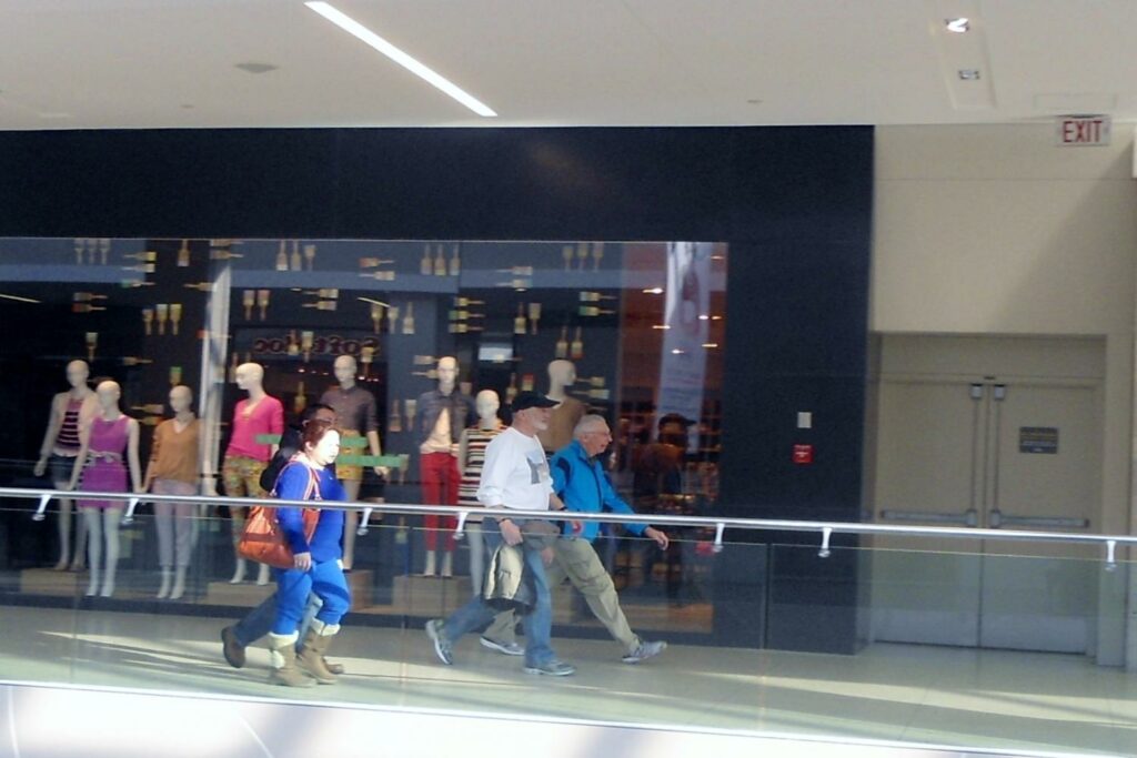
PT115 EDMONTON West Edmonton Mall This is a favourite walk for locals in the winter and also for visitors as they can tour West Edmonton Mall at the same time. If you want to walk without dodging people it is recommended that you start early enough to be done before the stores open.
JANUARY 1 – DECEMBER 31
SPONSOR St Albert Trekkers
CONTACT Martha 780-913-9779
REGISTRATION Online registration form
START POINT West Edmonton Mall, any entrance
INSTRUCTIONS
6, 7 & 10 km
RATING 1A
PROGRAMS APP M MW
TRAIL Indoor Mall walk. 07:00-21:00
PT118 EDMONTON River Valley This walk starts from the Kinsmen Sport Centre in the beautiful North Saskatchewan River Valley.
Route A is an all season route through the U of A and along Saskatchewan Drive
Route B goes through the U of A then along river valley trails. Parts of the trail are subject to freezing due to springs in bank. It suggested that you walk this trail in the summer months.
Route C a great preview of the U of A and also follows a dirt path along the North Saskatchewan River.
Route D explores more of the U of A Campus.
Route E explores the Rossdale neighbourhood via the new Walterdale bridge.
Route F trails along the river, out to the Cloverdale neighborhood and the Muttart Conservatory, returning through Nellie McClung and Queen Elizabeth Parks and under the new Walterdale Bridge
Route G & H Explores the River Valley further East from an alternate Start point at Dawson park (see link below)
JANUARY 1 – DECEMBER 31
SPONSOR St Albert Trekkers
CONTACT Joan 780-433-0282
REGISTRATION Online registration form
START POINT Kinsmen Sports Centre
9100 Walterdale Hill, T6E 2V3
Route G & H Dawson Park
10298 89 St NW Edmonton T5Z 0E7
INSTRUCTIONS
Route A – 10 km
Route B – 10 km
Route C – 6 km
Route D – 6 km
Route E – 5 km
Route F – 10 km
Route G – 6 & 7 km
Route H – 10 km
RATING 1A 1B 2A 2B 3B
PROGRAMS APP BW FC M MW
TRAIL See descriptions above
MISC Ample parking. Washrooms available inside Sports Centre.
PT133 EDMONTON Wolf Willow
Route A follows sidewalks in the residential section of Wolf Willow. Beautiful expensive homes line the route. This route is an all season walk.
Route B follows the sidewalks of Wolf Willow and the Multi Use trails of the surrounding ravines. It is best walked in the spring, summer and fall.
Route C This walk is similar to Route B except you get to cross a fabulous Pedestrian Bridge and walk up a flight of 200 steps!
Route D & E 5 Km These routes follows sidewalks in the residential section of Wolf Willow. Beautiful expensive homes line the route. These routes are all season walks.
Route F 5 Km Indoor track at Jamie Platz YMCA. Admission fee to use the track.
Route G 5 km This route uses sidewalk and Multi Use trails in Wolf Willow
JANUARY 1 – DECEMBER 31
SPONSOR St Albert Trekkers
CONTACT Martha 780-913-9779
REGISTRATION Online registration form
START POINT Co-op Gas Bar Wolf Willow
6827-170 St NW T5T 4W4
INSTRUCTIONS
Route A – 10 km
Route B – 9 km
Route C – 10 km
Route D – 5 km
Route E – 5 km
Route F – 5 km (alternate start point see above)
Route G – 5 km
RATING 1A 2B 3B
TRAIL See descriptions above.
MISC Washrooms available at Start Point.
PT222 EDMONTON Hermitage Park
Routes A & B – wind down into the beautiful North Saskatchewan River Valley.
Route C – is the least strenuous and tours residential areas.
Route D & E – have a mixture of residential and pathways with both routes overlooking the North Saskatchewan River as the trail winds along the top of the bank, almost to the Henday Bridge. Fantastic views and great trails.
JANUARY 1 – DECEMBER 31
SPONSOR St Albert Trekkers
CONTACT Duane 780-475-8976 duanespurrier@telus.net
REGISTRATION Online registration form
START POINT Sobeys, Belmont Shopping Centre
13504 Victoria Trail NW T5A 5C9
INSTRUCTIONS
Route A – 10 km
Route B – 5 km
Route C – 5 km
Route D – 10 km
Route E – 5 km
RATING 1A 1B 2B
TRAIL see descriptions above.
MISC. Route A & B aren’t stroller friendly and go through an off leash dog area. Other routes are stroller friendly.
PT226 EDMONTON Castle Downs This PT is based in North Edmonton and offers a choice of interesting routes.
Route A – Goes around beautiful Beaumaris Lake and residential/park areas.
Route B – Stays around the lake, perfect when sidewalks are icy.
Route C – Explores the new military commemorative park areas in Griesbach, the old army base.
Route D – 5 km route around Beaumaris Lake
Route E – 5 km route through part of the military commemorative park in Griesbach
Route F – 7 km route through part of the military commemorative Park in Griesbach
JANUARY 1 – DECEMBER 31
SPONSOR St Albert Trekkers
CONTACT Lou 780-289-0494
REGISTRATION Online registration form
START POINT Castle Downs YMCA
11510-153 Ave NW T5X 6A3
INSTRUCTIONS
Route A – 10 km
Route B – 10 km
Route C – 10 km
Route D – 5 km
Route E – 5 km
Route F – 7 km
RATING 1A 2B
PROGRAMS BW FC
TRAIL See descriptions above
MISC. Washrooms available inside the arena.
PT318 EDMONTON Twin Brooks This walk starts from the William Lutsky South Edmonton YMCA and winds through the Black Mud Creek trails and the sidewalks of Twin Brooks passing many beautiful yards and houses.
JANUARY 1 – DECEMBER 31
SPONSOR St Albert Trekkers
CONTACT Lou 780-289-0494
REGISTRATION Online registration form
START POINT William Lutsky South YMCA
1975 111 St NW T6J 7C6
INSTRUCTIONS
Route A – 10 km
Route B – 5 km
RATING 2B
PROGRAMS M
TRAIL Trails and sidewalks around Twin Brooks and the Blackmud Creek.
MISC Washrooms available at the Kinsmen Arena. Parking available.
PT336 EDMONTON South Central The south central routes utilize the trails along the Whitemud Creek as it makes it way to the South Saskatchewan River. These 5 routes along the Whitemud and North Saskatchewan River are very stunning and varied.
JANUARY 1 – DECEMBER 31
SPONSOR Northern Lights Walking Club
CONTACT Gisele 403-506-7176
REGISTRATION Online registration form
START POINTS
Terwillegar & Magrath Freson Bros. 5139 Mullen Rd T6R 0S9
Bulyea BPs 378 Bulyea Rd T6R 2B3
Hodgson Original Joe’s 2323 Rabbit Hill Rd NW T6R 3L6
MacTaggart Save-On-Foods 14161 23 Ave NW T6R 0G4
INSTRUCTIONS
Terwillegar & Magrath – 6 km and 10 km
Bulyea – 6 km and 11 km
Hodgson – 6 km and 10 km
Mactaggart – 6 & 10 km
RATING 1A 2B 3B
PROGRAMS FC MW
TRAIL Walk along the White Mud Creek/North Saskatchewan River and experience spectacular views.
MISC Washrooms available at start in nearby businesses
PT339 EDMONTON Southwest The Windermere routes will take you by some of the most luxurious homes in Edmonton. You will see man-made waterfalls and ponds on the Heritage Valley route. While the Chappelle Gardens explores the many trails, parks and lakes in that area.
JANUARY 1 – DECEMBER 31
SPONSOR Northern Lights Walking Club
CONTACT Diane
780-278-1140
REGISTRATION Online registration form
START POINTS
Buco Pizzeria and Vino Bar 1249 Windermere Way SW T6W 2P3
Heritage Valley & Chappelle Gardens Tim Hortons 14111 28 Ave SW T6W 3Y9
Keswick Tim Hortons 1317 175 St SW T6W 4H3
Ambleside California Pizza Kitchen 5260 Windermere Blvd SW T6W 0L9
INSTRUCTIONS
Windermere – 6 & 11 km
Heritage Valley – 5 & 10 km
Chappelle Gardens – 5 & 10 km
Keswick – 5 & 7 km and 10 km
Ambleside – 5 km and 10 km
RATING 1A/1B/2A/2B
PROGRAMS APP BW FC MW TW
TRAIL Paved trails around numerous man made lakes.
MISC Washrooms available at start in nearby businesses
PT341 EDMONTON Southeast (Summerside & Ellerslie) This permanent trail has 3 routes in southeast Edmonton. The Summerside walk goes by the largest man-made lake in the city and on a sunny day the beaches are full of people. The Mill Creek route follows the trails all along the Creek. Very woodsy and scenic. Explore the lakes and trails in the old and new parts of Ellerslie on the Ellerslie route.
JANUARY 1 – DECEMBER 31
SPONSOR Northern Lights Walking Club
CONTACT Sylvie
780-668-9018
REGISTRATION Online registration form
START POINTS
Summerside Shoppers Drug Mart 924-91 St SW T6X 1P2
Ellerslie Starbucks 5221 Ellerslie Rd SW T6X 1X2
INSTRUCTIONS
Summerside – 5 & 10 km
Ellerslie – 6 & 10 km
RATING 1B
PROGRAMS M
TRAIL Sidewalks, gravel and paved trails
MISC Washrooms available at start in nearby businesses
PT366 EDMONTON Blackmud Creek This walk goes by a number of man-made lakes and all along the creek. Three routes, one from the south, one from the north and one from the middle.
JANUARY 1 – DECEMBER 31
SPONSOR Northern Lights Walking Club
CONTACT Mary
780 920-5144
REGISTRATION Online registration form
START POINTS
South – Tim Hortons 361 Allard Blvd SW T6W 0J2
Middle – Dollarama 943 James Mowatt Tr SW T6W 1S4
North – TownePlace Suites by Marriott, 1115 103A St SW, T6W 2P6
INSTRUCTIONS
South – 6 km and 11 km
Middle – 6 & 10 km
North – 6 & 10 km
PROGRAMS MW
RATING 1A 1B
TRAIL The paved trails follow the Blackmud Creek.
MISC Washrooms available at start in nearby businesses
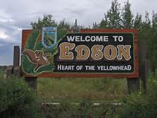
Edson
PT365 EDSON The town is located in Yellowhead County, 192 km west of Edmonton along the Yellowhead Highway. Residents of Edson are referred to as Edsonites.
JANUARY 1 – DECEMBER 31
SPONSOR CVF Alberta Director
CONTACT Denise
403-458-4316
REGISTRATION Online registration form
START POINT Edson & District Leisure Centre
1021 49 St. T7E 1T7
INSTRUCTIONS 5 & 10 km
RATING 1B
TRAIL Dawn to dusk. Route follows paved and natural trails through urban forests and residential sidewalks
MISC Ample parking and washrooms available at start point.
Elk Island National Park
PT006 Explore the rolling hills and glassy lakes of Elk Island National Park, a UNESCO Biosphere Reserve near Edmonton, which played an important part in the conservation of the Plains bison.
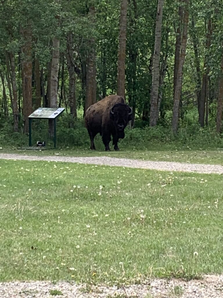
MAY 1 – OCTOBER 27
SPONSOR Northern Lights Walking Club
CONTACT Mary
780 920-5144
REGISTRATION Online registration form
START POINTS Elk Island National Park
Astotin Lake Recreation Area parking lot P1
Tawayik Lake Recreational Area parking lot
INSTRUCTIONS
Astotin Lake 5 & 10 km
Tawayik Lake 5 & 11 km
RATING 2B 3C
PROGRAMS BW
TRAIL Dawn to dusk. Well groomed trails through nature preserve. Washrooms at start.
MISC. National Park Pass required.
Fort Saskatchewan
PT311 FORT SASKATCHEWAN was, in 1875, under the command of Inspector W.D. Jarvis. The North-West Mounted Police established Fort Saskatchewan as a fort on the North Saskatchewan River. The community was later incorporated as a village in 1899, a town in 1904, and a city in 1985.
Route A & B uses mainly paved trails around the Northeast part of the city including downtown and the historic old fort area.
Route C uses mainly paved trails through parks and green spaces in the NE, includes a short section of dirt trail.
Route D – G uses both paved and unpaved routes through the park areas and some residential on the south side of the city.
Route H Alternate Start Point Turner Park uses paved trails, crossing pedestrian bridge over river, longer distance also tours the small village of Lamoureux and a short tour of downtown.
Route I Alternate Start Point Dow Centennial Centre indoor track. 15 full loops for 5 km, 30 loops for 10 km. Admission Fee
JANUARY 1 – DECEMBER 31
SPONSOR St Albert Trekkers
CONTACT Kathleen
780-998-1033
REGISTRATION Online registration form
START POINTS Westview Plaza
9713 90 St T8L 1K5
Turner Park
10306 104 St T8L 2B4
Dow Centennial Centre
8700 84 St T8L 4P5
INSTRUCTIONS
Route A – 10 km
Route B – 5 km
Route C – 10 km
Route D – 10 km
Route E – 10 km
Route F – 5 km
Route G – 5 km
Route H – 5 & 10 km Alternate start point see above
Route I – 5 & 10 km indoor option see alternate start point and instructions above
RATING 1A 1B 2A
PROGRAMS APP BW FC M MW TW
TRAIL Dawn to dusk.
MISC Free parking at all locations. Washrooms available
Fox Creek
PT116 FOX CREEK is located on Highway 43, approximately 259 km northwest of Edmonton. It was founded in 1971 and has a population of over 1700.
JANUARY 1 – DECEMBER 31
SPONSOR CVF Alberta Director
CONTACT Denise
403-458-4316
START POINT Petro Canada Service Station
52 Highway Ave., T0H 1P0
REGISTRATION Online registration form
INSTRUCTIONS & PROGRAMS
Route A – 10 km
Route B – 5 km
Route C – 6 km (alternate start point Northern Lights College 105 Campground Rd.)
RATING 1A 2B
PROGRAMS BW
TRAIL Route A & B go through the residential area on paved trails and sidewalks. Suitable for strollers. Route C is a bush walk
MISC Park facing Kaybob Dr. on left side of Station front door.
Grande Prairie
PT135 GRANDE PRAIRIE is the seventh-largest city in Alberta with a population over 67,000. It is located approximately 456 km northwest of Edmonton.
JANUARY 1 – DECEMBER 31
SPONSOR CVF Alberta Director
CONTACT Denise
403-458-4316
REGISTRATION Online registration form
START POINT Ernie Radbourne Pavilion
10326-102 Ave., T8V 1C3
INSTRUCTIONS Route A & B – 5 & 12 km
RATING 1A
PROGRAMS FC
TRAIL Paved trail and some sidewalk.
MISC Stroller friendly. All facilities at Pavilion. Ample parking on weekdays, more parking to the south if necessary.
Hinton
PT331 SEASONAL HINTON, with a population of almost 10000, is located 81 km northeast of Jasper and about 284 km west of Edmonton. The 5 km route follows the extensive Beaver Boardwalk around beaver ponds and in addition the longer route winds through the adjacent forest.
MAY 1 – OCTOBER 27
SPONSOR CVF Alberta Director
CONTACT Denise
403-458-4316
REGISTRATION Online registration form
START POINT Lions Park corner of Mountain St & Emerson Drive
INSTRUCTIONS Route A & B – 5 & 10 km
RATING 2B
PROGRAMS BW
TRAIL Paved trails, boardwalk, and dirt paths.
MISC Outhouse available at Start Point.
Innisfail
PT342 INNISFAIL is located in Central Alberta on Hwy #2 about 30 km south of Red Deer, its population is close to 8,000.
JANUARY 1 – DECEMBER 31
SPONSOR CVF Alberta Director
CONTACT Denise
403-458-4316
REGISTRATION Online registration form
START POINT Centennial Park
5303 50 St T4G 1S1
INSTRUCTIONS Route A & B – 6 & 10 km
RATING 1A
PROGRAMS BW FC M MW TW
TRAIL Sidewalks and multi-use trails
MISC Washrooms available at Start Point.
Jasper
PT315 JASPER Jasper National Park was established in 1907. The railway siding at the location of the future town site was established by Grand Trunk Pacific Railway in 1911
Route A goes around the town site.
Route B goes around Lake Annette and Edith. Start Point Lake Annette trailhead Parking lot 13. Road not open in the winter.
Route C goes past Old Fort Point and around Lake Beauvert passing Jasper Park Lodge.
JANUARY 1 – DECEMBER 31
CONTACT David 780-852-3241
REGISTRATION & START POINT Totem Ski Shop
408 Connaught Dr. T0E 1E0
Optional Online registration form
INSTRUCTIONS
Route A – 5 km Temporarily Closed
Route B – 5 & 10 km Not accessible in Winter
Route C – 10 km
RATING 1A 1B
PROGRAMS M
REGISTRATION at start point: 09:30 – 18:00 increased to 22:00 in Summer
TRAIL See descriptions above.
MISC National Park Pass required. Washrooms available on route.
Johnston Canyon
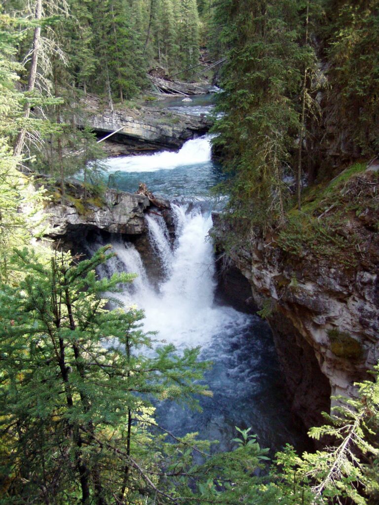
PT338 SEASONAL JOHNSTON CANYON This is one of the most popular walks in all the Rocky Mountains. The first 5 km (return) passes through a narrow canyon in which you will see two spectacular waterfalls. If you are up to seeing something very unique continue on up through the forest to the Ink Pots in Johnston Valley. (12 km return). The Ink Pots are six clear greenish pools filled with spring water that remains at a constant 1-degree Celsius year-round.
MAY 1 – OCTOBER 27
SPONSOR CVF Alberta Director
CONTACT Denise
403-458-4316
(Trails) Mary 403-493-9810
REGISTRATION Online registration form
START POINT Johnston Canyon parking lot
INSTRUCTIONS 5 & 12 km
RATING 2B 4C
PROGRAMS BW
TRAIL The first part of the trail walks through the majestic canyon past 2 waterfalls. The second part is up hill all the way to the Ink Pots.
MISC National Park Pass required. Washrooms available at Start Point.
Lacombe
PT360 LACOMBE is a great getaway from the busy urban environment into a truly natural surrounding of forest and wildlife.
Routes A & B – takes you through natural areas
Route C & D – tours historic downtown, murals and natural area
JANUARY 1 – DECEMBER 31
SPONSOR CVF Alberta Director
CONTACT Denise
403-458-4316
REGISTRATION Online registration form
START POINT Gary Moe Auto Group Sportsplex 5210 54 Ave Lacombe T4L 1H8
INSTRUCTIONS
Route A – 11 km
Route B – 6 km
Route C – 5 km
Route D – 10 km
RATING 1B 2B 3C
PROGRAMS FC M MW
TRAIL see description above
MISC. Washrooms available at Start Point.
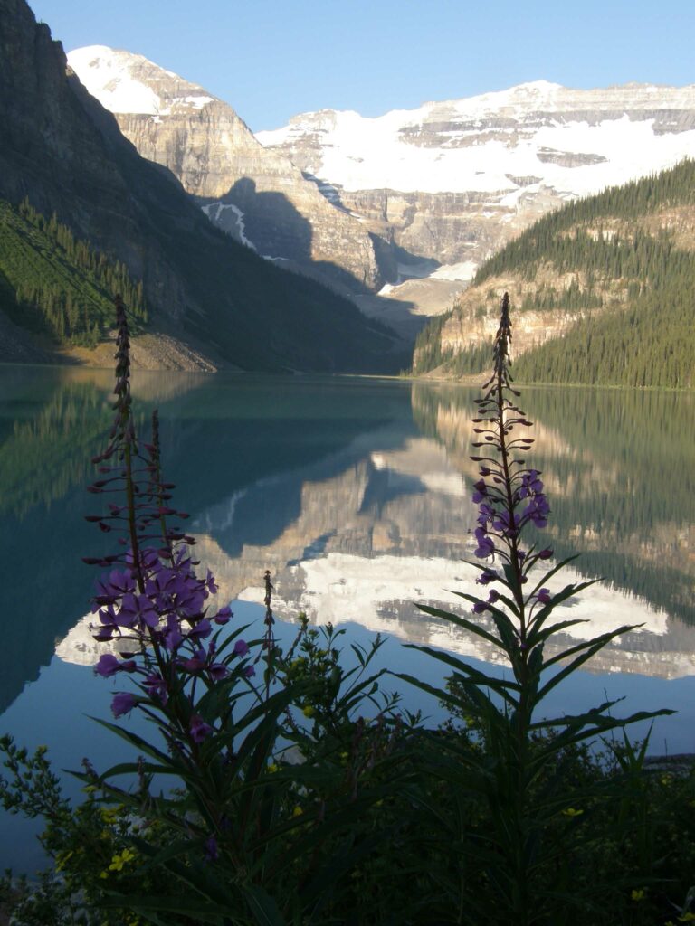
Lake Louise
PT343 LAKE LOUISE & LAKE AGNES: This route walks along beautiful Lake Louise and then the 12 km continues up a steep climb to Lake Agnes. This walk is at a very high altitude and may be closed due to snow. Perhaps the most beautiful walk in the Rockies.
Parking at the lake is limited and once it is full there is no access. Options when parking lot is full:
Park Canada Shuttle from parking lot 8 km east of Lake Louise – reservations must be made online, walk-up seats are not available. Further details are available here: https://www.pc.gc.ca/en/pn-np/ab/banff/visit/parkbus/louise. or ROAM bus from Banff. reservations recommended.
BOW RIVER LOOP: This 5 km route wanders along the Bow River Loop Trail starting from the railway station and avoids the parking problems at the lake.
JANUARY 1 – DECEMBER 31
SPONSOR CVF Alberta Director
CONTACT Denise
403-458-4316
(Trail) Mary 403-493-9810
REGISTRATION Online registration form
START POINT Lake Louise National Park parking lot
River Route: Station Restaurant and heritage railway station 200 Sentinel Rd. T0L 1E0
INSTRUCTIONS 5 & 12 km Lake walk. Only shorter distance is passable in winter.
5 km Bow River loop
RATING 1B 4C
PROGRAMS BW
TRAIL see description above
MISC National Park Pass required. Washrooms available at Start Point.
CVF PROGRAM Boardwalks
Leduc
PT016 EAST LEDUC is a city of close to 35,000. Located 33 km south of Edmonton on the Queen E Highway.
TELFORD LAKE ROUTE Starts at the Leduc Recreation Centre and explores Telford Lake. The 10 km goes all around the lake.
CITY CENTRE ROUTE Starts at the Recreation Centre and goes downtown
MEADOWVIEW VIA CAMPGROUND Starts at the Recreation Centre and goes through the Lions Campground and Meadowview
CALEDONIA VIA CAMPGROUND Starts at the Recreation Centre and goes through the Lions Campground and Caledonia
JANUARY 1 – DECEMBER 31
SPONSOR Northern Lights Walking Club
CONTACT Margaret
780 996-1015 margaret@lyall.ca
REGISTRATION Online registration form
START POINTS Leduc Recreation Centre, West Entrance, 4330 Black Gold Drive Leduc T9E 3C3
INSTRUCTIONS
Telford Lake Routes – 6 & 10 km
City Centre Route – 10 km and 6 km
Meadowview Via Campground Route – 10 km and 6 km
Caledonia Via Campground – 10 km and 6 km
RATING 1A
PROGRAMS BW M MW TW
TRAIL Around town on sidewalks and paved trails of park area.
MISC Washrooms and food available at start point.
PT077 WEST LEDUC was first established in 1899, when Robert Telford, a settler, bought land near a lake which would later bear his name. It was on that piece of land where the new settlement would take root.
JANUARY 1 – DECEMBER 31
SPONSOR Northern Lights Walking Club
CONTACT Mary
780 920-5144
REGISTRATION Online registration form
START POINTS Tim Hortons 5203 Discovery Way
Leduc T9E 6N4
Husky, 102 Southfork Drive Leduc T9E 0E9
INSTRUCTIONS
West Leduc – Golf Course – 6 & 10 km
West Leduc – 11 km and 5 km
Southfork – 10 km and 6 km
RATING 1A
PROGRAMS FC MW
TRAIL Around the west side of town on sidewalks and paved trails.
MISC Washrooms available at start and Tim’s is across the street
Lethbridge
PT225 LETHBRIDGE is Alberta’s third-largest city by population of over 100,000. It is located 210 km southeast of Calgary
JANUARY 1 – DECEMBER 31
SPONSOR CVF Alberta Director
CONTACT Denise
403-458-4316
REGISTRATION Online registration form
START POINTS Route A & B – Fort Whoop-Up (Indian Battle Park)
Route C – Sandman Inn parking lot
INSTRUCTIONS
Route A – 10 km
Route B – 5 km
Route C – 5 & 10 km
RATING 1A 3C
PROGRAMS APP FC MW
TRAIL at Fort Whoop-up in river valley. 10 km walk includes stairs. Henderson Lake route is flat on sidewalk and park trails.
Lloydminster
PT221 LLOYDMINSTER has the unusual distinction of straddling the Albert Saskatchewan border.

JANUARY 1 – DECEMBER 31
SPONSOR CVF Alberta Director
CONTACT Denise
403-458-4316
REGISTRATION Online registration form
START POINTS Bud Miller All Season Park 2902 59 Ave, T9V 3H5
INSTRUCTIONS 10 km and 5 km
RATING 1B
PROGRAMS FC MW TW
TRAIL Paved and natural trails through 200 acre Bud Miller Park and residential area
Medicine Hat
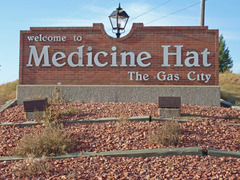
PT117 MEDICINE HAT is a city of over 65,000 people in southeast Alberta. It is approximately 169 km east of Lethbridge and 295 km southeast of Calgary.
JANUARY 1 – DECEMBER 31
SPONSOR Volkssport Club of Medicine Hat
CONTACT Sharon 403-526-7407
REGISTRATION Online registration form
START POINT Strathcona Park 210 5 St SE, T1A 7X4 Boat Launch
INSTRUCTIONS 5/6 km and 11 km
RATING 1A 2A
PROGRAMS BW MW TW
TRAIL Residential streets, paved and asphalt trails.
MISC Trail goes through some of the most scenic parks in Canada. Expect an abundance of wildlife.
PT074 MEDICINE HAT The name “Medicine Hat” is the English translation of ‘Saamis‘ (SA-MUS) the Blackfoot word for the eagle tail feather headdress worn by medicine men or ‘Medicine Hat’. Prior to the arrival of Europeans, the Blackfoot, Cree and Assiniboine nations used the area for hundreds of years.
JANUARY 1 – DECEMBER 31
SPONSOR Volkssport Club of Medicine Hat
CONTACT Sharon 403-526-7407
REGISTRATION Online registration form
START POINT: Kin Coulee Park bandshell Kin Coulee Road SE. T1A 1Y3
INSTRUCTIONS 6 km and 11 km
RATING 1A
PROGRAMS BW MW TW
TRAIL Residential streets, paved and asphalt trails through historic Medicine Hat.
MISC Note of Interest: downtown streets are lit by gas lamps.
PT040 MEDICINE HAT In 1883, when the Canadian Pacific Railway (CPR) reached Medicine Hat and crossed the river, a town site was established using the name from the Indian legends.
JANUARY 1 – DECEMBER 31
SPONSOR Volkssport Club of Medicine Hat
CONTACT Sharon 403-526-7407
REGISTRATION Online registration form
START POINT: Royal Canadian Legion
702-2 St. SE Medicine Hat T1A 0E1
INSTRUCTIONS 6 km and 11 km
RATING 1A 2B
PROGRAMS APP BW FC TW
TRAIL goes along the river and through several parks. Residential streets, red shale and asphalt trails, some stairs.
PT333 MEDICINE HAT The Medicine Hat landscape is dominated by the South Saskatchewan River Valley. In addition to this major river, both the Seven Persons Creek and Ross Creek empty into the South Saskatchewan River within the city boundary. The presence of these water bodies provide for a dramatic valley landscape with numerous cliffs and finger coulees throughout the city.
JANUARY 1 – DECEMBER 31
SPONSOR Volkssport Club of Medicine Hat
CONTACT Sharon 403-526-7407
REGISTRATION Online registration form
START POINT Big Marble Go Centre 2000 Division Ave. NW. T1C 1X9
INSTRUCTIONS 6 & 11 km
RATING 2B
TRAIL Sidewalks and asphalt trails through parks and urban areas. Some shale and stairs.
MISC Plenty of parking.
PT362 MEDICINE HAT Redcliff is situated at a high elevation relative to the surrounding landscape, the Town of Redcliff offers views of the South Saskatchewan River Valley, the city of Medicine Hat, and the Cypress Hills. The cliffs that overlook the river valley resemble badland formations.
JANUARY 1 – DECEMBER 31
SPONSOR Volkssport Club of Medicine Hat
CONTACT Sharon 403-526-7407
REGISTRATION Online registration form
START POINT Riverview Golf Club, 700 Redcliff Way SE, Redcliff T0J 2P0
INSTRUCTIONS 7 km and 11 km
RATING 1B 3B
TRAIL Sidewalks, paved and red shale trails.
MISC Plenty of parking. .
Millet
PT078 SEASONAL MILLET is a town is located approximately 40 km south of Edmonton. The town has won nationally in the Communities in Bloom competition and markets its beautiful setting. With a population of over 1800.
MAY 1 – OCTOBER 27
SPONSOR Northern Lights Walking Club
CONTACT Theresa
780 907-6966
REGISTRATION Online registration form
START POINT Fresh Market Foods
5302 Hwy#2A T0C 1Z0
INSTRUCTIONS 6 & 10 km
RATING 2B
PROGRAMS MW TW
TRAIL Along shale & paved paths beside the Creek, in the park and along streets of Millet.
Moraine Lake
PT344 SEASONAL MORAINE LAKE is a glacially-fed lake in Banff National Park 14 km from the Village of Lake Louise. It is situated in the Valley of the Ten Peaks, at an elevation of approximately 6,183 feet. Being glacially fed, the lake does not reach its crest until mid to late June. When it is full, it reflects a distinct shade of blue, due to the refraction of light off the rock flour deposited in the lake on a continual basis.
NO PRIVATE VEHICLE ACCESS. Shuttles and bus access only. For reservations and further details check website here: https://www.pc.gc.ca/en/pn-np/ab/banff/visit/parkbus/louise.
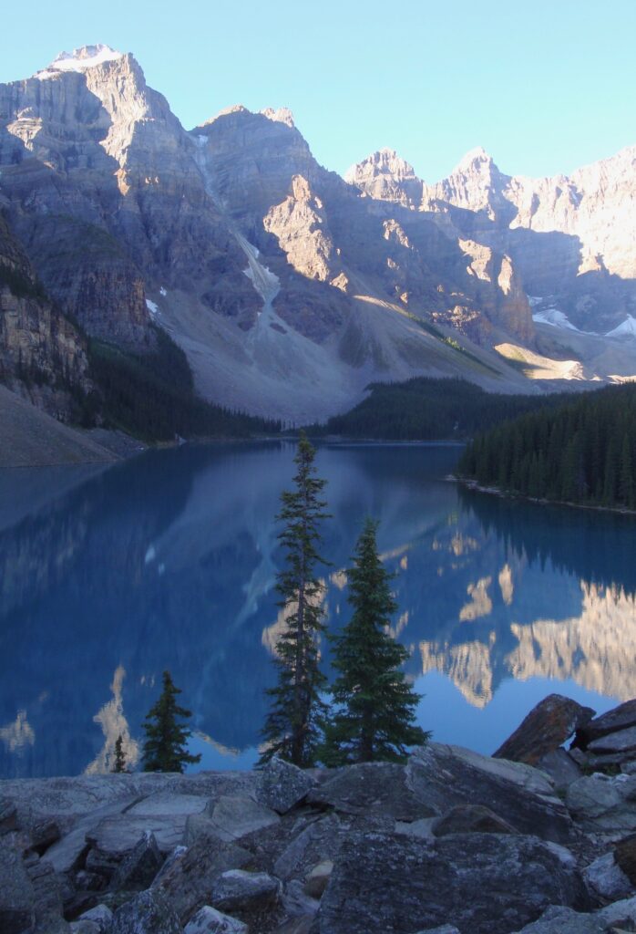
JUNE 1 – Mid OCTOBER (check bus/shuttle schedules)
SPONSOR CVF Alberta Director
CONTACT Denise
403-458-4316
(Trail) Mary 403-493-9810
REGISTRATION Online registration form
START POINT Moraine Lake parking lot
INSTRUCTIONS 5 & 10 km
RATING 2C 3C
TRAIL The 5 km part of the trail is along the shores of Moraine Lake. The 10 km part takes you up the mountain to Consolation Lakes.
MISC National Park Pass required. The Consolation Lakes trail requires walkers to be in groups of 4 or more and carry bear spray, July to September. Washrooms available at Start Point.
Morinville/Legal
PT141 MORINVILLE is located 34 km north of Edmonton with over 10,000 citizens. The walk starts from the Morinville Fish and Game Pond and follows a paved trail along the edge of town and through residential areas to downtown. Check out the alternate route in the small community of Legal (under 1500), another 9 km north of Morinville, which celebrates Legal’s French heritage through over 35 murals.
JANUARY 1 – DECEMBER 31
SPONSOR St Albert Trekkers
CONTACT Sharon
780-340-5769
REGISTRATION Online registration form
START POINTS
Morinville Walk Location
Legal Walk Location
INSTRUCTIONS
Morinville Route A – 10 km
Route B – 5 km
Legal Route C – 10 km
Route D – 5 km
RATING 1A 1B
PROGRAMS FC M MW TW
TRAIL Mainly paved trails and residential streets.
MISC Alternate route in Legal.(no washroom available at that start point).
Okotoks
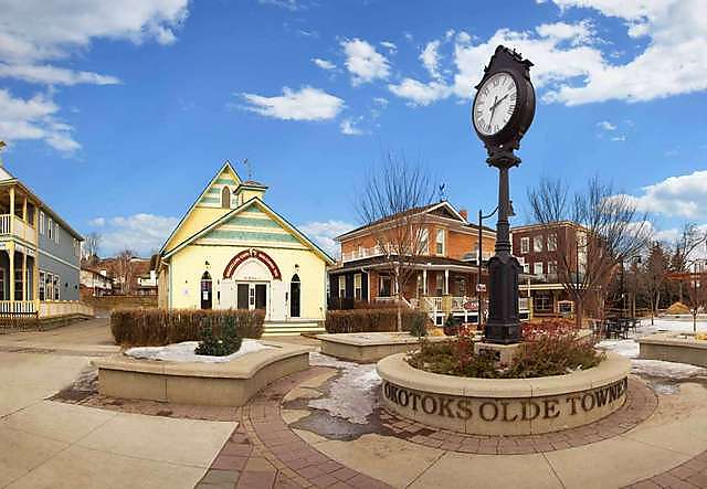
PT142 OKOTOKS is another beautiful Alberta town situated 18 km south of Calgary. with a population of over 31,000. The route goes along the Sheep River and explores the downtown.
JANUARY 1 – DECEMBER 31
SPONSOR CVF Alberta Director
CONTACT Denise
403-458-4316
REGISTRATION Online registration form
START POINT Okotoks Visitor Center
53 North Railway St T1S 1J3
INSTRUCTIONS
Route A – 10 km
Route B – 6 km
RATING 2A
PROGRAMS APP M TW
TRAIL Dawn to dusk. Route follows the Sheep River as it winds through town and along the historic streets of the Olde Town District.
MISC Washrooms available at start point and on route.
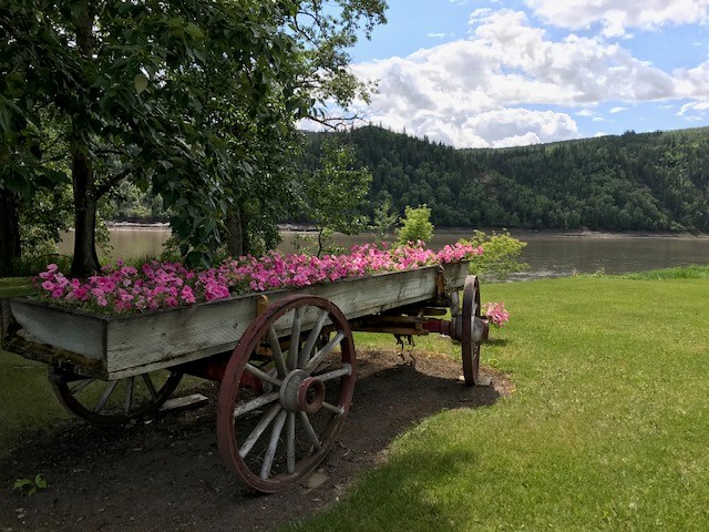
Peace River
PT368 SEASONAL PEACE RIVER the town is situated on the banks of the Peace River at its confluence with the Smoky River, the Heart River and Pat’s Creek.
MAY 1 – OCTOBER 27
SPONSOR CVF Alberta Director
CONTACT Denise
403-458-4316
REGISTRATION Online registration form
START POINT River Drive Mall,
10122 100 St
INSTRUCTIONS 5 & 10 km
RATING 1A
PROGRAMS FC TW
TRAIL The trail winds along the banks of the Peace River. Great views.
MISC Washrooms available at Start Point.
Red Deer
PT361 RED DEER Great getaway from the busy urban environment into a truly natural surrounding of forest and wildlife.
Route A– 6 & 10 km South Bank Trail to Mackenzie Trail. (The trail explores – trails, streets, bridges, river and trees)
Route B – 5 km McKenzie Trail – (The trail explores – trails, streets, bridges, river, ponds and trees)
Route C – 10 km Coronation & Barrett Park Loop
Route D – 5 km Coronation & Barrett Park Loop
Route E -7 km Gaetz Lake Sanctuary & Michael O’Brien Wetland
JANUARY 1 – DECEMBER 31
SPONSOR CVF Alberta Director
CONTACT Denise
403-458-4316
REGISTRATION Online registration form
START POINT Kerry Wood Nature Centre
6300 45 Ave. T4N 3M4
INSTRUCTIONS
Route A – 6 & 10 km Temporarily closed due to construction
Route B – 5 km
Route C – 10 km
Route D – 5 km
Route E – 7 km
RATING 1A 2B 3B
PROGRAMS APP BW FC
TRAIL Natural forest
MISC Use overflow parking. Washrooms available at Start Point when open 1000-1700; Extended summer hours 1000-2000; Holidays 1300-1700. Closed Christmas Day.
PT363 RED DEER is located in aspen parkland, a region of rolling hills that is home to oil, grain, and cattle production. It is also a centre for oil and agriculture distribution.
Route A & B take in the Heritage Ranch and Bower Ponds.
Route C alternate start point Red Deer Recreation Centre. Historical Walk in the Footsteps “Ghost Collection” Sculptures

JANUARY 1 – DECEMBER 31
SPONSOR CVF Alberta Director
CONTACT Denise
403-458-4316
REGISTRATION Online registration form
START POINT Bower Ponds Pavilion
4715 Fountain Dr. T4N 6W4
INSTRUCTIONS
Route A – 10 km
Route B – 6 km
Route C – 5 and 10 km (Alternate start point see above)
RATING 1B 2B
PROGRAMS APP BW FC M MW TW
TRAIL Explores several historic points.
MISC Washrooms available during business hours.
Sherwood Park
PT052 SHERWOOD PARK is the largest hamlet in Alberta with over 70,000 residents. located on the eastern boundary of Edmonton.
Route A – Ball Lake – This 11 km walk crosses Ball Lake to an Island, by some very nice residential homes and then through Heritage Hills wetlands.
Route B 6 km – This walk goes to an island on Ball Lake.
Route C – This walk starts from the Strathcona Wilderness Centre located 20 minutes east of Sherwood Park on Range Road 212. The route winds around the wooded wilderness trails where moose and deer are frequently seen. NOT WALKABLE IN WINTER.
Route D Walk inside Sherwood Park Mall. Starting at the entrance by the food court, stay right and walk into each entrance, omitting restroom hallways. Walk 6 laps for 5 km and 12 laps for 10 km.
JANUARY 1 – DECEMBER 31
SPONSOR St. Albert Trekkers Volkssport Club
CONTACT Sandra 780-318-6883
REGISTRATION Online registration form
START POINT Sherwood Park Mall Food court entrance parking lot at rear
2020 Sherwood Dr. T8A 3H9
INSTRUCTIONS
Route A – 11 km
Route B – 6 km
Route C – 5 & 10 km (Alternate Start point, see above)
Route D – 5 & 10 km, indoor option see instructions above
RATING 1A 2B
TRAIL See walk descriptions above
MISC Washroom available at start.
PT314 SHERWOOD PARK In 1953, permission was received from the Municipal District of Strathcona for the development of the residential hamlet named “Campbelltown” and in September 1955, the first model homes were opened to the public. Later in 1956, the name of the hamlet was changed to Sherwood Park, because Canada Post would not approve Campbelltown, since there were several Canadian communities with similar names.
Route A – This route takes you to the only covered bridge in the Edmonton area and around a beautiful lake in Broadmoor Park.
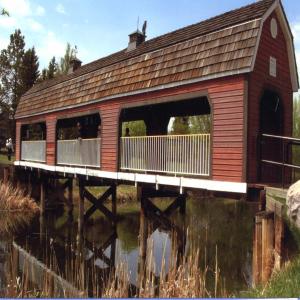
Route B – Broadmoor Park – This route goes around the beautiful lake in Broadmoor Park.
Route C – Walk to the covered Bridge, pictured below.
Route D – Walk Inside at Millennium Place – walk around the indoor track 43 times for a 10 km or 22 times for a 5 km walk. Admission fee required.
Route E & F – Walk starts from the East parking lot D at Millennium Place – walk through the Centennial Park area on paved and natural trails.
JANUARY 1 – DECEMBER 31
SPONSOR St. Albert Trekkers Volkssport Club
CONTACT Sandra 780-318-6883
REGISTRATION Online registration form
START POINT Sherwood Park Mall Food court entrance parking lot at rear
2020 Sherwood Dr. T8A 3H9
INSTRUCTIONS
Route A – 10 km
Route B – 5 km
Route C – 5 km
Route D – 5 & 10 Km Alternate Start point, see above and also indoor walk instructions
Route E – 10 km Alternate Start point, see above
Route F – 5 km Alternate Start point, see above
RATING 1A 1B 1C
PROGRAMS APP M MW TW
TRAIL See walk descriptions above
MISC Washroom available at start.
St Albert
PT002 ST ALBERT The Lakes The thriving community of St Albert, with a population of over 68,000, is adjacent to the City of Edmonton’s NW border.
Route A – Big Lake
Route B – Heritage Lakes
Route C – Big Lake via Levasseur
Route D – Big Lake
Route E – Big Lake: longer distance includes the John E. Poole boardwalk
Route F – Big Lake, John E. Poole boardwalk, field and longer distance does some residential starts at Lois Hole Centennial Provincial Park
Route G – Riverside starts from St Albert Place parking lot
Route H – Lacombe Lake Park starts from St Albert Place parking lot
Route I – Riverside route starts from St Albert Centre, Entrance 4 near Cora (most likely to have the clearest trail in bad conditions)
Route J – Gray Nuns White Spruce Forest, Big Lake, John E. Poole boardwalk, and longer distance continues into the fields at Lois Hole Park, starts at Lois Hole Centennial Provincial Park
25 Km option – this PT is also registered for 25 km, use the instructions from PT #32 below
JANUARY 1 – DECEMBER 31
SPONSOR St Albert Trekkers
CONTACT Gisele 403-506-7175
REGISTRATION Online registration form
START POINT St. Albert Inn & Suites
156 St. Albert Trail, T8N 0P5
INSTRUCTIONS
Route A– 5, 10 & 11 km
Route B – 6 & 10 km
Route C – 11 km
Route D – 14 km
Route E – 10 & 11 km
Route F – 5 & 10 km Alternate start point, see above.
Route G – 5 km Alternate start point, see above
Route H – 5 km Alternate start point, see above
Route I – 5 & 10 km
Route J – 5 & 10 km
25 km see instructions in PT #32 bike
RATING 1A 1B 2A 2B
PROGRAMS APP BW FC M MW
TRAIL See walk descriptions above
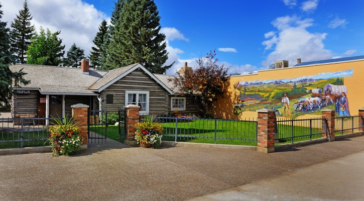
PT131 ST ALBERT Historical was founded in 1861 by Father Albert Lacombe, who built a small chapel, the Father Lacombe Chapel in the Sturgeon River Valley. This chapel still stands to this day on Mission Hill. St. Albert first received its town status in 1904 and became a city in 1977.
Route A – Art and History.
Route B – Art and History. Includes historical notes. Starts at St Albert Place parking lot
Route C – Akinsdale and Forest Lawn ravine
Route D – Grandin and River walk
Route E – downtown and River walk, includes historical notes. Starts at St Albert Place parking lot
Route F – Sturgeon and downtown.
Route G – Braeside and Woodland walk. Starts at Kingswood Park
JANUARY 1 – DECEMBER 31
SPONSOR St Albert Trekkers
CONTACT Gisele 403-506-7175
REGISTRATION Online registration form
START POINT St. Albert Inn & Suites
156 St. Albert Trail T8N 0P5
INSTRUCTIONS
Route A – 10 km
Route B – 10 km Alternate start point, see above
Route C – 5 km
Route D – 5km
Route E – 5 km Alternate start point, see above
Route F – 5km
Route G – 6 km Alternate start point, see above
RATING 1A 2A 2B
TRAIL See walk descriptions above.
PROGRAMS APP FC M MW TW
MISC This is the St. Albert HISTORICAL walk and some instructions include details, see above.
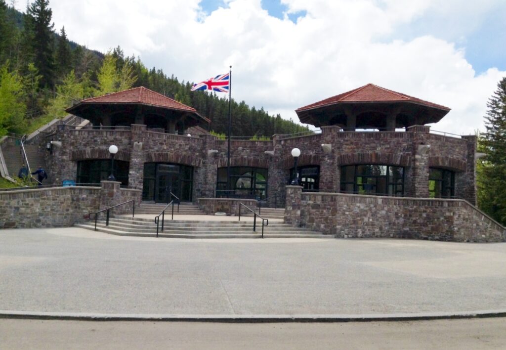
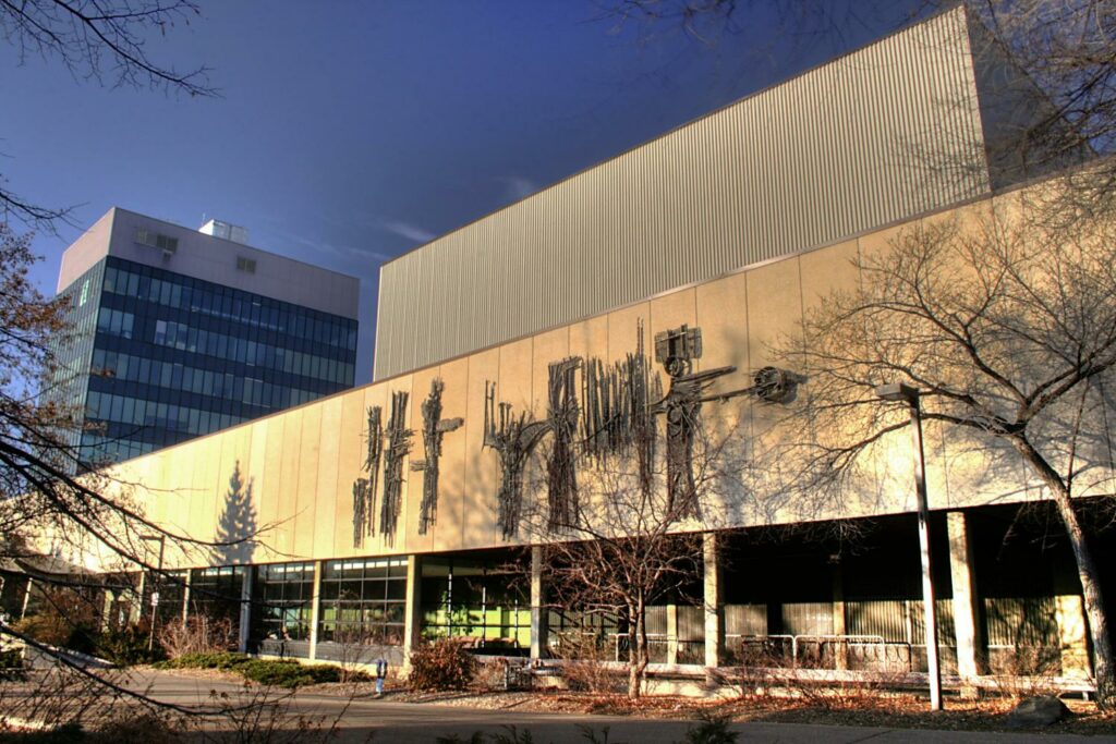
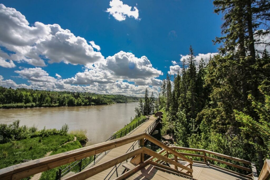
PT132 ST ALBERT Best Western Located in the heart of downtown, St. Albert Place (photo) is the focal point of many community events and activities. Designed by world-renowned Canadian architect Douglas Cardinal, its sculptural symmetry mimics the curves of the Sturgeon River that runs behind it. There are no corners; only curves. Built in 1984, St. Albert Place was designed as a “people place”, housing a unique combination of civic government and cultural activity. (seen on Route A)
Route A – walks around residential neighborhoods and along the Sturgeon River.
Route B – winds around the northern residential and park areas..
Route C – a very scenic route through the northern part of the city
Route D – walk inside St Albert Centre
Route E – through residential and park areas
Route F – through residential and park areas

JANUARY 1 – DECEMBER 31
SPONSOR St Albert Trekkers
CONTACT Gisele 403-506-7175
REGISTRATION Online registration form
START POINT Best Western St. Albert
460 St. Albert Tr., T8N 5J9
INSTRUCTIONS
Route A – 10 km
Route B – 10 km
Route C – 5 km
Route D – 5 & 10 km alternate start point, see above
Route E – 10 km
Route F – 5 km
RATING 1A 2A
PROGRAMS APP BW FC M
TRAIL See route descriptions above.
MISC. Washrooms available at Tim Horton’s behind hotel.
PT320 ST ALBERT Servus Place and SEASONAL SKI hike the remainder of the year
Route A : through both east and west trails of River Lot 56 and residential streets.
Route B : through River Lot 56 east side, some rough ground to get there and back.
Route C : Indoor track available on third floor. Admission fee to use the track.
Route D : Cross Country Ski. Refer to maps on trail heads of River Lot 56. First location Poundmaker Road, second location Kingswood Park. Make your own route for the distance you require using this map.
Route E : mainly on sidewalks and trails. Great for when River Lot is icy or has too many mosquitoes.
Route F : starts at the Kingswood Park using multi use trails, sidewalks and River Lot 56
Route G : starting at Kingswood Park this route is all on well groomed trails in River Lot 56
Route H : Parkwood Akinsdale starts at Century Casino
Route I : Bellerose River Walk starts from Dog Park Parking on Bellerose Drive going through some estate areas
JANUARY 1 – DECEMBER 31
SPONSOR St Albert Trekkers
CONTACT Sylvie 780-668-9018
REGISTRATION Online registration form
START POINT Servus Credit Union Place
400 Campbell Rd. T8N 0R8
INSTRUCTIONS
Route A – 10 km
Route B – 6 km
Route C – 5, 6 & 10 km
Route D – 5, 6 & 10 alternate start point, see above
Route E – 5 & 10 km
Route F – 11 km alternate start point, see above
Route G – 6 km alternate start point, see above
Route H – 5 km Alternate start point, see above
Route I – 5 & 10 km Alternate start point, see above
RATING 1A 1B 2A 2B 2C
PROGRAMS M
TRAIL See walk descriptions above
PT032 SEASONAL ST. ALBERT Cycle The Northern Alberta International Children’s Festival in St. Albert is one of the longest-running children’s festivals in North America, attracting over 40,000 participants over 5 days, at the end of May. During the five days of the Festival, children experience sights and sounds of many different cultures while learning through the medium nearest and dearest to their hearts – by playing!
MAY 1 – OCTOBER 27
SPONSOR St Albert Trekkers
CONTACT Gisele 403-506-7175
REGISTRATION Online registration form
START POINT St. Albert Inn & Suites
156 St. Albert Trail , T8N 0P5 Free parking in front.
INSTRUCTIONS
10 km
14 km
20 km
25 km
RATING 1A 2A 2B
PROGRAMS APP FC M
TRAIL Residential areas and along the trails of Red Willow Park.
MISC Take time to visit City Hall, St. Albert Place designed by Douglas Cardinal, and the original Mission on the hill.
Spruce Grove/Stony Plain
PT051 SPRUCE GROVE This city of nearly 40,000 is located 11 km west of Edmonton along Highway 16 or Highway 16A. The trail system that winds its way through the urban forest shows why the city deserves its name.
STONY PLAIN just on the other side of Spruce Grove on Highway 16A has under 20,000 citizens
JANUARY 1 – DECEMBER 31
SPONSOR St Albert Trekkers
CONTACT Sharon
780-340-5769
REGISTRATION Online registration form
START POINTS TransAlta Tri Leisure Centre
221 Jennifer Heil Way Spruce Grove T7X 4J5
Grant Fuhr Arena
9 Agrena Rd Spruce Grove T7X 2C8
Freson Bros. Fresh Market
4416 48 St. Stony Plain T7Z 1N3
INSTRUCTIONS
Spruce Grove
Tri Leisure Centre
5 km and 10 km
Grant Fuhr Arena
5 km and 10 km
Stony Plain
6 km and 10 km
RATING 1A 1B
PROGRAMS APP BW FC M TW
TRAIL Paved trails and sidewalks through forest, parks and residential areas. The Stony route tours their downtown murals
MISC Free parking
Stettler
PT279 This small town of just under 6000 was founded in 1905 and named after Carl Stettler, a Swiss immigrant, farmer, postmaster and town counselor.
JANUARY 1 – DECEMBER 31
SPONSOR CVF Alberta Director
CONTACT Denise
403-458-4316
REGISTRATION Online registration form
START POINT Stettler Mall 6610 50 Ave T0C 2L2
INSTUCTIONS
Route A 6 km
Route B 10 km
Route C 6 km
RATING 1A
PROGRAMS FC TW
TRAIL Explore the town
MISC: Washroom and parking available at start point
Sundre
PT369 SEASONAL SUNDRE is a town of just under 3000 residents surrounded by Mountain View County. It was named after the home town in Norway of the first Postmaster. Approximately 100 km northwest of Calgary on the Cowboy Trail in the foothills of the Canadian Rockies.
MAY 1 – OCTOBER 27
SPONSOR CVF Alberta Director
CONTACT Denise
403-458-4316
REGISTRATION Online registration form
START POINT Boondox Restaurant,
110 Main Avenue W T0M 1X0
INSTUCTIONS 6 km and 10 km
RATING 2B
PROGRAMS FC M
TRAIL Trails near the Red Deer River and Snake Hill Recreation Area
MISC: Free parking and restroom at start point
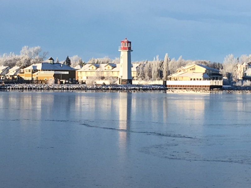
Sylvan Lake
PT313 SYLVAN LAKE This tourist town of just over 16,000 is located 25 km west of Red Deer along Highway 11 or Highway 11A. It is situated on the southeast edge of Sylvan Lake, a 15 km long freshwater lake
ROUTE A: scenic walk taking in the Lighthouse, pier and waterfront.
ROUTE B: highlights of route A plus treed multi-use trail, RCMP station, Fire Hall and Town Hall.
ROUTE C: route A plus treed MUT and walks parallel to the Railroad tracks.
JANUARY 1 – DECEMBER 31
SPONSOR CVF Alberta Director
CONTACT Denise
403-458-4316
REGISTRATION Online registration form
START POINT North Promenade Parking Lot 4719 50 Ave.
INSTRUCTIONS (routes revised due to construction)
Route A – 5 km
Route B – 10 km
Route C – 10 km
RATING 1A
PROGRAMS APP BW RT TW Lighthouse
TRAIL Trails and sidewalks.
Taber
PT345 TABER, A very pleasant walk on multi-use trails and sidewalks through some of the residential areas, downtown and around the golf course.
JANUARY 1 – DECEMBER 31
SPONSOR CVF Alberta Director
CONTACT Denise
403-458-4316
REGISTRATION Online registration form
START POINT Aquafun Centre
4700 50 St. T1G 2B6
INSTRUCTIONS
Route A – 10 km
Route B – 5 km
RATING 1A
PROGRAMS M MW TW
TRAIL City sidewalks and multi-use trails
Vegreville
PT332 VEGREVILLE A nice stroll through parks and sidewalks past the iconic giant pysanka. The 10 km has a short stretch through a nature area.
JANUARY 1 – DECEMBER 31
SPONSOR CVF Alberta Director
CONTACT Denise
403-458-4316
REGISTRATION Online registration form
START POINT Elks/Kinsmen Park
4500 Pysanka Ave. T9C 1C6
INSTRUCTIONS
Routes A & B – 7 & 10 km
RATING 1B
PROGRAMS FC M TW
TRAIL City streets, multi-use trails plus a section of nature trail on 10 km.
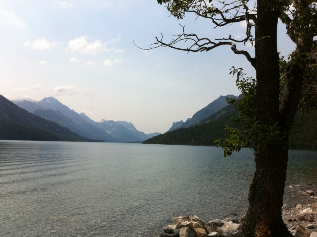
Waterton
PT143 SEASONAL WATERTON VILLAGE In the heart of Waterton National Park is the Village. It’s scenically located on a small delta which is closely guarded by the Rocky Mountains to the north and west and Upper Waterton Lake to the east and south. Waterton Village is 56 km west of Cardston on Hwy 5.
MAY 1 – OCTOBER 27
SPONSOR CVF Alberta Director
CONTACT Denise
403-458-4316
REGISTRATION Online registration form
START POINT Waterton Lakes National Park Visitor Centre
404 Cameron Falls Dr TOK 2M0
INSTRUCTIONS
Route A – 6 km
Route B – 10 km
RATING 2B (trails may not be passable until snow melts)
PROGRAMS BW FC MW
TRAIL Paved and gravel trails along the lake shore, through woods and town. Watch for wildlife. Consider stopping at the Prince of Wales Hotel for the view and refreshments.
MISC National Park pass required. Free parking on streets. Public washrooms available throughout park.
Wetaskiwin
PT017 WETASKIWIN A small city of over 12,000, located 70 km south of Edmonton. Its name comes from the Cree word wÄ«taskÄ«win-ispatinaw, meaning “the hills where peace was made”.
JANUARY 1 – DECEMBER 31
SPONSOR Northern Lights Walking Club
CONTACT Mary
780 920-5144
REGISTRATION Online registration form
START POINT By the Lake Park
6128 56 Ave T9A 3C9
INSTRUCTIONS 5, 6 & 10 km
RATING 1A
PROGRAMS FC M MW
TRAIL Route circles a beautiful lake, before the 10 km route heads into town. Washrooms available at start.
Whitecourt
PT111 WHITECOURT This town of just over 10,200 is located approximately 180 km northwest of Edmonton.
JANUARY 1 – DECEMBER 31
SPONSOR CVF Alberta Director
CONTACT Denise
403-458-4316
REGISTRATION Online registration form
START POINT Information Centre
3002-33 St. T7S 1N9
INSTRUCTIONS 5 & 10 km
RATING 2A
TRAIL Paved trails and sidewalks, suitable for strollers. Washrooms at start when open.
MISC Parking available.